We have been anchored in various spots in Mobjack Bay for the last ten days or so. Quiet, peaceful and serene. That is, until the other day. We had a line of thunderstorms ride over us, bringing gusty winds touching 50 knots a couple of times. We were oriented fairly well as the winds were mostly out of the southwest.
North River, Mobjack Bay. North is up.
The winds were strong enough to kick up some waterspouts as the gusts were funneled down Back Creek just west of us. With the winds came some pretty heavy rain, so between the rain and the waterspouts, visibility was poor.
Prior to the arrival of the storms I had been watching their advance on my radar app. While there was a NOAA warning for high winds and hail, I didn’t pay a lot of attention. (NOAA is always saying that..). I was looking at the intensity of the cells and it kinda looked like the strongest cells would pass both north and south of us so I wasn’t too worried as we made our way to the pilot house to watch the show.
As the skies darkened I took one last look at the radar update and saw the gap between the two cells disappear and nothing but red filled the screen in front of our location symbol on my iPad. At that point the wind arrived and I was beginning to think I had underestimated the intensity of this one. Probably should have started the engines as well. Nothing behind us to drag into, however.
When the wind arrived the gusts went from 20 knots to 50+ knots quickly and the direction changed 20-30 degrees with each gust. AT 85,000 lbs, we don’t usually get pushed around or heel much. But a couple of the gusts caught us broadside, pushing us over about 20 degrees and sending us off in a new direction.
The sensation when we reached the end of our chain was more a subtle deceleration than an abrupt snatch and I would ascribe this to the fact that we were anchored in deep mud and I would guess the last ten feet of chain was in the mud. I go into all this description because as trawler cruisers we prepare our boats to handle this sort of weather event but rarely see it. What follows is anecdotal, one person’s experience in one specific event, but possibly some general rules of thumb can be drawn from the lessons learned.
First off then, a bit about our anchorage. We chose the spot to provide some protection from the south. There were some tall trees on land but most of the terrain around here is low and the river beds slope gradually to the shore so one can’t anchor too close to land. In the photo below you can see how far out the docks run in order to find navigable water.
North river anchorage. Privateer looking south towards land.
After the storm abated I went out in the dinghy and checked depths. Turns out we could have moved about 200′ closer to shore. When we arrived here a few days prior, the wind was out of the north so limited what we could do with what was then the lee shore. Once I knew a storm was coming we could have moved a lot closer to land and the protection of the trees.
Our tackle consists of a 55kg Rocna Vulcan anchor with 7/16″ HT chain. We use a 1.25″ nylon snubber that feeds from a deck hawse down to a bow eye at the waterline and then to the chain, connecting with a soft shackle. The effective length of the snubber is about 13′.
At this location we saw 10′ at high tide and had 70′ of chain out, measured from the bow eye, so 7:1. When we pulled anchor the next day I estimated that the anchor was sitting 3′-5′ below the depth read by the transducer. Based on our track before and after the event, I would estimate we dragged about 10′.
All that description reads like a pretty typical set up and anchoring routine. One question some might have is about the size of the snubber line, at 1.25″ way oversize for the job and unlikely to stretch at all. In the past I used lesser diameter line in order to provide stretch and reduce the violence of the snubbing event. I tried to estimate the loads, then subtract the strength degradation due to knots, wear and tear, the change in direction at the bow eye, etc. Then I tried to estimate what the “just right” amount of stretch should be, 10% would be helpful, 20% might weaken the line..? And what wind strength should I use in the equation?
In the end, I gave up on the goldilocks snubber, installed the mother of all snubbers and forgave stretchiness as a feature. In this one specific weather event, with this bottom material and this scope, it turned out I didn’t need any stretch. The boat rounded up at the end of each swing relatively smoothly. I can attribute that observation to either the weight of the chain or the mud it had to pull through, or both.
We anchor a lot in the Bahamas, usually in good sand. A typical set often looks like the photo below.
anchored in the Exumas
We see 30 knots in the Bahamas often. A couple of times I have gone down to observe the action of the anchor and chain in these conditions. What I find is that with 70′ of chain out, in 10′ of water, the last 20′ will stay on the seabed through most of the swings of the boat. At the end of the swing the direction of pull changes about 20 degrees and there will be a modest tug at the chain to anchor shackle. So at 30 knots, the chain maintains at least some catenary even at the end of a swing and the “snub” is gentle. The feeling of motion while on the boat is minor at 30 knots, more noticeable at 35-40 knots and at 50 knots the sensation is strong enough to suggest I need to hold onto something.
A note about all this for any sailors out there reading this. When at anchor in high winds on our sailboat we would actually sail from one swing to the next, accelerating right up until we came to the end of the chain. The arrival was abrupt, along with the change in direction. We also covered a lot more territory than we do with this trawler. On Privateer we decelerate as we approach the end of the chain and then fall off in the other direction. This action is easier on the chain and snubber than it was on the sailboat, so sailors might take all this with a grain of salt and stick to their stretchy snubbers.
Guide to cruising Jumentos Cays and Ragged Islands
(Updated March 2023. Includes visits in 2020, 2022 and 2023)
We first visited the Jumentos chain of islands in 2020 on our return from the Turks and Caicos. We were impressed by both the beauty and the desolation and made plans to return when we had more time to explore in depth.
Our cruising plans were curtailed by Covid last year so when a weather window opened this February, we headed south from Long Island. What follows are our observations and experience, but we are not experts on the area. Cruising here can be challenging, so anyone contemplating coming down ought to gather as much advance information as possible. We recommend The Island Hopping Digital Guide to the Southern Bahamas, Part II, The Jumentos by Stephen Pavlidis, which includes the Ragged Islands.
Jumentos and Ragged Islands Guidebook
Jumentos Cays chain of islands
Navigation Challenges
Cruising the Jumentos brings a few challenges. The islands are uninhabited, except for Duncan Town on Ragged Island in the far south. Provisioning in this small town is quite limited, so best you arrive with the assumption that you will be self-sufficient for the length of your visit. Those who stay down here for extended periods can arrange for mail boat delivery of provisions, but since we were planning to stay for just a few weeks we did not pursue that option. There are no repair facilities, fuel, water or propane. The only internet or cell service comes from the tower at Duncan Town.
The next significant challenge is the lack of any all-around protected anchorages, should a significant front arrive during your stay. Experienced cruisers told us that to stay here through a major front with winds clocking through 360 degrees you need to be prepared to move from one protected anchorage to another during the front, possibly at night. We weathered mild fronts during both our stays and I will cover our experience in dealing with fronts here later in this post. Personally, moving from one anchorage to another during a front is not something we wish to do, especially at night. So our plan, had a major front threatened, was to run back to protection at Long Island or Great Exuma. For a plan such as this to be viable, one needs access to weather with plenty of advance notice regarding fronts. With limited to no cell coverage in most of these cays, an SSB or a satellite phone is essential equipment.
Anchoring
In general, holding is good throughout the chain, meaning that with a little effort you will be able to find deep sand. However, there are areas where the sand is in a narrow band along the shore, or where sandy areas are in pockets surrounded by rock and rubble. For this blog, if I say the holding is good, it means that I dove on the anchor, or could see it from the bow or the dinghy, and confirmed a good set. In areas we didn’t anchor, I have commented on what I saw from the boat or the dinghy. Finally, most of the anchorages have at least some coral that might require careful selection of your spot so I won’t repeat that warning with every anchorage discussion. You will see two different anchor symbols on the charts I use in this post. The dark green dots are mine and the light green dots are Active Captain anchor notations. The charts themselves are Explorer.
Getting There
There are three options for getting to the Jumentos; Hog Cay cut, across the Great Bahama Bank, or through Comer Channel. Of the three, we have only used the Comer Channel route. Departing from Thompson Bay, Long Island, this happens to be the shortest route. As to the other two routes I can only mention what I have picked up from other cruisers who have used these routes. The banks route offers the most protected approach and boats with 5-6′ draft can run from the Exumas while staying on the banks the entire way. Note that much of this route includes visual piloting rules (VPR) due to the coral heads.
Banks Route
The Hog Cay Cut route can shave 20+ miles off the trip from Georgetown versus using Comer Channel. But for our vessel with a 5′ draft, we would need to manage the tides to clear the shallow hump on the south side of the cut. On our trip back from the Jumentos, we looked closely at coming through the cut. But high tide was late in the day, and the tide that day was a relatively low high, so we went around via Comer Channel. From every source I could find regarding Hog Cay Cut, many of them conflicting, the controlling depth is around 4-5′ at low tide, but we were not able to confirm this. Low tide is about 45 minutes after Nassau low tide. The best guide book for this cut is another by Stephen Pavlidis, this one on the Exumas.
Hog Cay Cut
We have run the Comer Channel twice and have not seen anything less than 7′ at low tide. Clear water and white sand makes for a startling view as you can count every blade of grass and starfish as you pass through.
Comer Channel RoutePrivateer’s shadow cast on the seabed in Comer Channel
It is about 100 miles from Thompson Bay to Duncan town via Comer Channel, so most folks break the trip into two days. Popular Day 1 stops include Water Cay and Flamingo Cay. Note that the fishing off the windward/deep ocean side of these islands can be excellent. With calm conditions, we did a portion of the trip offshore (instead of the protected shallow banks ) and caught a nice Little Tunny.
(Update March 2023) Expecting to extend our good luck fishing we ran from ragged to Water with line in the water. We caught nine Barracuda but nothing we wanted to keep. After the first few catches we moved into deeper water to avoid them. That didn’t happen. The last two we caught were in 1000′ or more. Go figure.
Little Tunny
Places to anchor
The first decent anchorage you will encounter is at Water Cay. We have anchored there twice, once in the North end and once in the center of the Cay.
water Cay Northern anchorages
Beginning at the North end of the island in the Fishing Boat Anchorage, our selected spot ( the northernmost anchor symbol) in 2020 provided good holding and good protection, but winds and swell were mild. This is the best spot on the island for swell from the North if you can tuck in all the way. That evening 8-10 small fishing boats came in to anchor for the night, all politely away from us. They did clean fish so I suspect there were plenty of sharks around.
This year we checked out the southern portion of this bay, looking for protection from brisk east winds. This spot, the middle anchor symbol in the photo above , forms more of a pocket than the charts imply and would provide some protection from southern wrap-around swell.
Despite a bit of swell, we chose a spot off what the chart calls a “Prominent Rectangular Rock”. This is a particularly scenic spot with views across a land bridge to the ocean beyond.
View from our anchor out to the open ocean
There are some anchorages further South on the island and we checked them out via the dinghy.
Water Cay South anchorages
The upper anchor spot in the South provides good wind protection from the NE. Although not evident on the charts, the land is steep sided right up to the shore and the area is deep enough to press in fairly close to the cliff. I would expect some surge from the South. The lower mark is large and deep enough and will allow some protection from swell. The land is low so there would be no wind protection. Both spots look to have a sandy bottom but we did not try to anchor in either spot.
Southbound, the next anchoring opportunity is Flamingo Cay. We anchored here on our way South and again when North bound. The island has some attractive beaches a few trails and a cave you can enter in your dinghy.
Flamingo Cay North
The anchorage with the AC symbol (light green square) is popular and will often be crowded. It carries 6′ at low close to the beach. Folks still call it “Two Palms” but both palms are now gone. The good anchoring sand goes out from the bay to a line just past the anchor symbols at about the 12-15′ deep. Beyond that, the area is rock rubble and hard. We anchored well at our symbol but a boat which came in after us was unable to get a set. There is a trail from the Two Palms beach that begins in the NE corner of the beach and crosses over to the bay and anchorage at the north end of the island. Along the way are pools full of bright red shrimp.
We walked over to observe the anchorage in the North bay. It was a nice slot with a catamaran anchored. With moderate SE breeze, there was only a small chop wrapping around into the anchorage.
There are also anchoring spots just a little north of Two Palms anchorage, between the two anchor symbols on the Flamingo Cay North chart image. We anchored in the northernmost spot, between the finger of land and some coral rubble. Our spot was about 15′ deep and good holding in deep sand. There was a nice view through a slot in the land to the North anchorage and the ocean beyond.
South of the Two Palms area is another indentation and beach that shows an AC symbol. I show a “No Anchoring” symbol here because the sand is in a narrow band in 5-7′ at low. To get a good set you need to come pretty close to the shore and may not have swing room if the wind shifts. We tried to get a set here just a bit further off the beach and dragged in rocky rubble. If you are confident the wind will remain East overnight, this area could work. The sandy area is deeper as you go further south. Friends in a catamaran who were anchored here had an unpleasant night when the wind died and the current, mild as it was, swung them towards the shallow beach.
Cave on Flamingo Cay
This cave is just South of the central anchorage. We went in at low tide and had just enough head clearance. There was a bit of surge so we didn’t attempt to beach the dinghy. You can also enter from land through an opening in the back via a short trail from the beach. Remains of Giant Tortoise have been discovered by archeologists here.
(Update March 2023) Flamingo Cay South Anchorage
We found a nice spot to anchor near the south end of the island. This works well when the other anchorages are full and good sand is hard to find. This spot would be good as long as there is no SE swell running. The small shallow bay just north of where we anchored is rumored to be full of conch.
Flamingo South
We anchored in 12′. None of the coral near our spot was high enough to obstruct us. We exited the banks the next day via Sloop Cut just to the south.
Buenavista North
The banks-side shore on Buenavista offers decent anchoring in a band of sand just off the beach. Too close and you will be in rubble and too far out you will be in rock and coral. The good sand is in a wide band from about 6′ to 10′ at low. With wind from NE to E, there is a nice pocket in the NE corner of the beach, at the symbol. Midway down the beach there is a well marked trail to the other side of the island that looks into Low Water Harbour at the South end of the island. This was our go-to spot for protection from a weather front.
Cold Fronts, Where to go
This spot deserves an extended write-up since it is one of only a few spots that provide protection during a cold front. This area provides good protection from NW through NE and moderate protection from W and E. Swell works in from the West, but reefs offshore limit swell from the NE and E.
The image above is from the Explorer charts but the Navionics view is more accurate. The area around our anchor symbol is mostly deeper than portrayed. You can see our track as we swung at anchor. This spot is mostly 7′ at low, with one small hump at about 6′ that we swung through occasionally. To the NE of this spot, the area gets a bit more shallow, but to the SW and W, the area gets deeper. The area carries 8′ another 200′ closer to shore before it shoals.
On our 2023 visit we again needed a hiding place from a moderate front with winds from NNW through NE. This time we anchored aside Low Water Harbour Cay . The area is larger and deeper than implied from the charts. Mostly 7-8′ and 6′ to within 100′ of the cay itself. Room for 2-3 boats, depending on alignment. You can see the track from our anchoring spot last year. Either spot is good but this year’s spot was much less crowded.
Privateer at Low Water Harbour
In 2022 we were the one of the first boats to arrive, a few days before the front. But another 8-10 boats came in later. Several catamarans anchored between us and the land and a few monohulls parked south and east of us. The winds maxed at 27 knots gusting to 33 knots and nobody dragged anchor. As the wind clocked around to NE we expected some surge through the slot to the NE of us, but it never happened as the reef structure further out mostly prevented any significant swell.
This year (2023) our spot picked up more fetch and some minor swell from the cut but the lack of any boats nearby made it a good trade for us. get there early and enjoy the trails and snorkeling. The cruisers who chased lobster had good luck.
Snorkel Spot near Low Water Harbour
Low Water Harbour, things to do
There are trails off the beaches and the snorkeling on the reefs is excellent. The spot shown in the image is well protected from waves and swell and the current is minimal. We were able to anchor the dinghy nearby, tucked well up in the slot to the South of the fish symbol. The ledges are full of lobster and the grassy flats nearby are full of conch.
A few fishy friends
Cold Fronts, other options
Speaking of cold fronts, there are three or four anchorages popular for weathering a cold front. Low Water Harbour works well for West through NE, as I can attest. Two years ago we anchored on Southside Bay which was OK, but rolly so we had our flopper stoppers out. The other two, Man O’ War Bay on the south end of Racoon Cay and the cut between Ragged and Little Ragged Islands are also popular, but we didn’t anchor at either location. Note that boats with 6′ draft anchor in this cut, but they need to work the tides. Ten boats were anchored in this cut during the cold front.
Man O’ War Cay South anchorageCut “Between the Raggeds”
Racoon Cay
House Bay on the lee of Racoon Cay provides some protection from prevailing winds. We anchored in the north end of the bay but had to leave when the wind moved a bit South of East and the wrap around swell found us.
Pimlico Cay, at the southern end of House Bay provides some options for escaping a northerly or southerly swell. You can tuck in close on the north side of Pimlico, but on the south side the shallow and rocky bottom projects a ways out from the shore.
House Bay North anchorageUse Pimlico Cay to play the swell
Hog Cay
Moving on to Hog Cay, Middle Pen Bay provides excellent holding and protection from NE through SE. Large areas of shallow sand to the north minimize any swell from the NE through E. Although we didn’t experience it, I would expect some swell from the South with any significant SE wind. There is no protection from any wind with a West component
Middle Pen Bay at Hog Cay
. We were anchored in the second row of boats in 10′ of water. The area carries 6′ to near the beach. Just South of this spot, there are a few shallower spots. We shared the area with 20 other boats, with some stretched out well to the North of us. Room for many more.
Cruiser Tiki hut on Hog Cay
Hog cay is where most of the cruising fleet hangs out when weather permits. The tiki hut provides shade and a place for evening happy hours. We really enjoyed the discussions with the other cruisers. There were a few newbies like us but also a number of folks who had been coming here for many years and spent most of the season here. They were a wealth of knowledge about the area, where to anchor, what to see, how to provision, etc. I cant help but think that this was what cruising in the Exumas might have been like 20-30 years ago.
Lisa enters our crab in the great crab racePrivateer in the second row at Middle Pen Bay
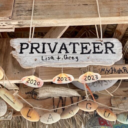
We spent four days here, and walked a different trail each day. We added to our sea bean and shell collection while getting a bit of exercise. Lisa also added our name board to the rafters of the hut.
Privateer joins the fleet at the Hog Cay Yacht ClubPrivateer sign with 2023 shellPersephone adds another year
Every February the town, led by Maxine who runs the general store, stages a feast for the cruisers. The money collected from donations and an auction goes to fund the school. Average boat count for February is about 20 boats, but for the parry there were over 40. This year they collected nearly $5K.
The auction
Cruisers donate treasures from the bilge for the auction. Stuff like fishing gear and household appliances are popular and the bidding by the towns folk can get quite animated.
This year’s group photoOn normal evenings the cruisers gather at the hut for happy hour and often some good music.Lisa learns how to weave baskets from locally grown palm fronds
The Hog Cay Yacht Club is a unique stop for any cruiser. In both our visits we met sailors who were closing the circle on their circumnavigations right there at Hog Cay. And they had plenty fellow circumnavigators to trade stories with. Makes for an interesting happy hour.
Conch blowing contestLisa gets ready for Junkanoo
Ragged Island
We visited Duncan Town in 2020 but didn’t make it back there this year.(updated 2023). There are two ways to get to town, a long dingy ride up the trench from the NW, or a long walk up the hill from the anchorage at Southside.
Southside anchorage on Ragged Island
Southside is another anchorage that is popular during a cold front. It is not possible to snuggle up far enough to avoid the swell from the SE through West, but works well for NW through NE and E. Lots of weed with strings of sand for anchoring. We stayed here for a frontal passage in 2020 and needed to deploy our flopper stoppers in order to manage the swell.
Privateer with Flopper Stoppers deployed
(Update 2023)
We made a return trip to Duncan Town this year. It was good to see that they have made some progress with rebuilding from the hurricane five years ago. The solar field is operational and the new school is about to open. A community center and town headquarters building is close to completion. And rumor has it a dinghy dock is in the works.
If you come by dinghy there is a dredged channel from the northwest. All but one of the marker buoys are gone but with good light its easy to find the channel through the flats that leads you to a dredged channel through the mangroves.
Approach to Duncan Town feeder channelThe edges of the channel are easy to see in good light
The dredged channel is mostly >3′ at low but the area in red above, is 2′ or less so watch your prop. The one mark remaining is a small float.
The town is more welcoming than the sign might suggest
We spent about two weeks in the Jumentos and counted ourselves lucky we only had to deal with one mild cold front. On our first cruise down here we saw very few boats but this year there were many. Thirty or forty boats can spread out up and down the chain when the weather is mild, but they all will funnel in to the few protected anchorages when the cold fronts come through. Should you be here for a front, I suggest you find a good spot early in the process.
Fronts aside, a Jumentos cruise provides beautiful scenery, mostly untouched nature and room to stretch out and enjoy the solitude of private anchorages. And you can always find a friendly bunch of experienced fellow cruisers at the Hog Cay Yacht Club, should you look for a little company.
We made it to Key West, a milestone of sorts. We are here for a month or so and will celebrate Christmas with our two sons. Then it is off to the Bahamas.
The leg from Canaveral to Key West was relaxed as we had time to kill before our slip reservation at Boca Chica Marina near Key West. Our first night out promised to be lumpy with strong winds out of the North so we chose Suntex Marina (formerly Loggerhead) in Vero Beach. We had never been there and were somewhat concerned about the channel as there were numerous Active Captain comments about hard obstructions in or near the channel. All I can say is that we had no issues and I would estimate at least 6′ at low tide. Once inside, the marina was very nice and totally protected.
We followed up with some locals regarding the channel and one fellow provided us a set of soundings that he had taken with his dinghy. Those soundings did show some shoal area encroaching on a portion of the channel, not quite reaching the centerline. I am sure those write-ups in AC were true, in that the boats hit something, but maybe not so accurate in that whetever they hit, it was not on centerline. We left the next morning following our breadrumbs from the day before without any problems.
The charts show just a few pilings but there are actually 8-10 on each side of the channel so it isnt that hard to stay centered. If anyone wants a copy of the soundings for the channel, send me an email.
A note on Active Captain. I read the reviews and check the hazzard comments on my route, but often the hazzards just arent there. All I can figure is that the authors just werent where they thought they were when they encountered the problem. As best I can tell, nobody reviews the data and once a hazard is logged, it stays on the charts forever, despite numerous comments that the hazard just isnt there. More on this later.
Our next stop was Peck Lake. This is another interesting spot becasue the charts show the area to be 3-5′ deep when there is a large area 10′ or greater. But the only way to figure out just how large the area is requires probing with your hull. Not my favorite. In this case, the AC comments are helpful as they describe where the “gate” is as you leave the ICW and enter the anchorage.
For us it was fairly easy because there were just a few boats there. We picked a spot with plenty of swing room and felt a good set on the anchor. By the way, you know how a dog circles his spot before lying down? I understand that is to insure he doesnt cover a gopher hole or whatever. Well the same sort of move works with a boat. If we arent sure we will have minimum depth throughout our predicted swing we will circle our spot to confirm, doggy style.
It looked like a fine evening, until the bugs arrived. And did they ever. By morning we were covered in bugs that looked sort of like mosquitoes but didn’t bite. They just left stains everywhere. And they stayed with us for days. What a mess.
Lake Worth inlet and anchoring options
Our next stop was Lake Worth to an anchorage just south of the inlet. There are three options for anchoring here. Just south of the inlet, at the northern most AC symbol, you can anchor just south of the channel. It is close if you want to enter or leave in the dark. But the current is strong and it is quite deep at 20′ or so. The next spot, just south of the large spoil area, is close to the inlet but somewhat crowded with a mix of moored and anchored boats. Further south, roughly east of Rybovich Marina, is 1.7 miles from the inlet but wide open. We chose this spot and had a pleasant night.
We left the next morning just before sunrise. There is added light from land so not so hard to leave in the dark and run along the docks to the inlet. Lucky for us, the weather was perfect for an outside run to Miami, skipping the most concentrated series of bridges along the Florida coast.
Venetian Islands Anchorage
We have anchored here a few times. Well protected but can be busy with tour boats, jet skis and the like. Better on weekdays. There are a couple of No Anchor spots as well. Under current Florida anchoring laws there are very few places you cannot anchor. These are some of them. The houses here are all million dollar plus and the rumor is, a few have enough political pull to prevent boats from disturbing their views. Whatever, still plenty of places to anchor that are out of the way of traffic and protected. Last year we anchored between San Marino and Di Lido, this year just SE of Palm. A good place to wait on a hop east to the Bahamas or, in our case, south to the Keys.
Our plan was to stay inside Biscayne Bay to Anglefish Creek, then go out to Hawk Channel for the rest of the trip to Key West.
Anglefish Creek
Anglefish Creek is one of the last places a boat drawing 5′ or more can exit to Hawk Channel. The ICW continues but there are large portions where the depth is less than 5′, especially at anything but high tide. But reading the AC comments about the creek suggests there are areas of less than 5′ in the channel as well as hidden obstructions. Here is another example where blind allegiance to AC comments will keep you from going places that are safe.
Since we had a few days to kill, waiting on weather, I took the dinghy out and sounded the entire creek. I also talked with numerous boats passing through the creek in both directions. From my readings the lowest points are at the entrance and exit from the creek. On the Biscayne Bay side, the lowest point is 7′ MLLW and on the Hawk channel side, 6’3′. And I could not find any obstruction between marks 1 and 3 as AC described. I did chat with the author of the AC obstruction comment and I am sure he really did hit something at that point, but my guess is, it was some sort of partially sunk log that had since drifted off.
Our first time in Hawk Channel. My two comments; the barrier reef does cut the swell from the east, but doesn’t really help with the wind driven wave. And the number of crab floats will keep you paying close attention to your path through the mine field.
There are not a lot of anchorages with much protection from anything above 15 knots from the east so a run down Hawk channel requires a bit of weather planning. There are only a few bridges that will allow a cross over to the other side of the Keys in order to get out of wind or wave. We anchored one night on the far side of Channel Five Bridge and then went to a marina in Marathon to avoid a cold front.
WE spent a few days at Marathon Marina and Resort, just inside the channel into Boot Key Harbor. A very nice marina that is cruiser friendly and has decent rates for extended stays. Marathon served our purposes well but we had a hard time appreciating the attraction to the mooring field in Boot Key Harbor. Hundreds of boats here, many for the season. Nice weather, good protection and cheap rates, but not particularly attractive. And it is hard to fall in love with the town of Marathon itself.
We did enjoy a tour of the Turtle Hospital in Marathon, which is a real working turtle rehabilitation facility. Tours are a little pricey at $25 or so, but since the proceeds are important to funding their work, then maybe not so bad. We also checked out the bars in the area and give two thumbs up to the french fries at Burdine’s.
We next headed to Boca Chica and our marina for a month. Boca Chica is home to Key West Naval station airfield and an MWR marina. The marina was a mess after the last hurricane, with many boats sunk in their slips, but now it is up and running and nearly full. Not all repairs are complete but it is in pretty good shape. Tiki bar, small restaurant, beach, etc. And $1/ft. But only for military.
We are about seven miles from old town Key West, so having a car is helpful. We have been doing the tourist things in town, and it is a touristy town, but it is also a town with plenty of legitimate history if you look past the Tee shirt shops on Duval street. Maybe a dedicated blog post on Key West in the future.
The boys are both here for Christmas so their christmas present was a day of deep sea fishing. Fishing is a big deal here, with hundreds of charter boats available so choosing one boat was a challenge. We did a lot of internet searching but finally settled on a boat we had seen arriving at the dock by our happy hour bar. Among the six boats at the dock, this boat had the most fish. We chatted up the captain and liked him and hired he and his deck hand for the day before christmas. The boat name was Triple Time and I would recommend it. An older boat but a great crew. And of the returning boats, we had the biggest catch.
The catch
We caught all five tuna in about an hour. None before or after. Other boats that missed the window got nothing. Our captain said he had been doing this for 40 years so I am guessing our success was not just luck. The biggest tune weighed in at 25 lbs. We are still eating it.
We would have had one more tuna but a shark beat us to it.
We have had enough weather surprises, mostly disappointments on this trip south, when actual conditions were worse than forecast. Nice to get a pleasant surprise now and then as we did for the trip from Savannah to Cape Canaveral. Overnight we had 10 knots from behind, a 2′ swell and 90% illumination all night. It just does not get any better than that.
Lets back up a bit. Our near term destination for this leg was to get to Key West in time to host our two sons for Christmas. We had five weeks, more than enough time to take it easy and maybe add a few side trips. our plan was to travel offshore whenever weather permitted, limiting it to one overnight at a time. Once we arrived in Florida we no longer had to worry too much about weather as we could always run inside, but we really wanted to avoid the leg between Lake Worth and Miami as the number of bridges can really get to be a pain in the neck.
From Mobjack we we next stopped at Atlantic Yacht Basin. Decent fuel prices, no current, friendly folk. Our favorite activity here is to tour the covered docks. Some beautiful older boats, including a spectacular Trumpy, in pristine condition.
Coinjock may become a tradition. A short run from AYB so we arrived early, which is good here, and enjoyed our prime rib. Coinjock dock hands are famous for stacking boats tightly here, often with overhang fore and aft, so getting here early makes arrival and tie up easier. Best you not be watching as they bring boats in behind you. And also best if you let some of the boats depart first.
From Coinjock we took the “road (somewhat) less traveled” down Pamlico Sound, stopping in Manteo and Ocracoke. Overall, this route is shorter than the ICW, less crowded and with fewer hazzards. The only drawback is that Pamlico Sound can get rather nasty in any significant winds. A 20 knot wind can set up a rather nasty 3 foot, 3 second wave pattern than is uncomfortable even for us. Our route is in blue, the ICW in green.
The Pamlico Sound route
Manteo has a nice small marina, some anchoring opportunities and plenty of land adventure opportunities. The entrance channel is a little tricky, but holds aout 7′ at low tide at the worst spot. Note that sustained east or west winds can lower or raise depths by a foot or two. We rented bikes and went to Ft Raleigh, checked out the Lost Colony and the Alligator River National Wildlife Sanctuary Visitor Center. Oddly, while the actual sanctuary is on the peninsula astride the Alligator River, the Visitor Center is on Roanoke Island. Not sure why except maybe Roanoke is the closest civilization. The town of Manteo is pretty touristy, but still interesting. Enough locals live here to keep most shops and restaurants open even so late in the season.
The local museum is a short walkBrings back memories of me as a kid. Outboards used to be hard to start
Ocracoke is sort of the gateway to the Outer Banks, with large ferries arriving every half hour in season. When we got there, in early November, the ferries were hourly but disgorged fewer travellers, mostly fishermen towing their center console boats from the mainland.
The channel to the basin is well marked and deep but there was some confusion due to recent dredging and changes in bouy locations. As we approached I watched a few ferries come and go on AIS and then adjusted my plotted route to overlay their tracks. That worked out pretty well as some of the route cuts across what the chart shows as shoal, and on the wrong side of a charted red buoy. As it turned out, you can ignore the charts and follow your eyeballs and do just fine. In most of the channel there is plenty of room to pass a ferry going the other way, but there are a few choke points so most cruisers either follow a ferry in or wait till the outgoing ferry exits. You can look up the ferry schedules on line and use that unfo to plan your trip in.
Once inside the basin there is a large area for anchoring and a few marinas. We docked at the NPS docks, which are very nice, and cheap for us. With a NPS pass, the dockage was $37 per night, including power. Unfortunately, quite a bit of dock space is not taken up by a new fast ferry dock located between the two floating docks, preventing access to any of this dock space.
This time of year, many stores and restaurants are closed but there are enough things open to satisfy your urge for fried whatever. We again rented bikes and went out to the shore. Pretty spectacular beaches with hardly any people. We walked a mile or so on one beach and never saw another person. Nice time to visit.
From Pamlico sound we rejoined the ICW and went to Morehead City Yacht Basin, which has become our staging point for running offshore. But this year the weather didn’t play nice so we stayed inside from Morehead City to Bald head. Not many good anchoring spots on this leg if you want to do it with one stop enroute so we booked a slip at Topsail Island Marina in Surf City. So, we are about 10 miles out from the marina, it is 3:30pm and we get a call from the marina on VHF. They tell us they are quite sorry but they had double booked our slip and it was now occupied. too bad, so sorry, good luck finding somewhere else to go. As the Seinfeld skit goes, they new how to take a reservation, they just didn’t know how to keep a reservation.
This put us in a bit of a bind. We called a few other marinas in the general area, but no luck. Searching the charts I found an anchorage that might work if we could get there before dark as we would have to clear the Surf City Bridge and it was on an hourly schedule. We went to mak speed, which for us is not much over 9 knots, and made the 5pm bridge with a few minutes to spare. Another 15 minutes to the anchorage and we had the anchor set by sundown. Not sure what we would have done if that had not worked out. Another boat in a similar situation as ours, who didnt make the bridge, anchored out in the ICW overnight. I cant imagine that working out well. Cruisers own the days on the ICW, tugs and barges own the night.
As it turned out, this was a very nice anchorage and we will use it again, I am sure.
Topsail Sound at Sloop Point Anchorage
Next day we went to Bald Head marina. Well protected and well situated for an offshore run. We rented bicycles and toured the island. From there we made an offshore hop to Savannah, stopping at Thunderbolt marina. The Krispy Cream donuts remain a big hit. We spent a day doing the tourist things, parks, old homes, restaurants, etc. before heading offshore again to Port Canaveral.
One of the many parks in downtown Savannah
As I mentioned ealier, the trp from Savannah to Port Canaveral was about as good as it gets. Calm seas, clear skies and full moon all night. We spent a few nights at Ocean Club marina and took a side trip to tour NASA’s Cape Kennedy site. Expensive at $50/pp ut worth it. takes a full day to see everything. We went on Thanksgiving day and that was a good choice as the place was nearly empty. Maybe 200 people for a place that is set up to handle thousands. Perfect.
Saturn V is a monsterThe shuttle up closethis is a working shuttle landing simulator. I crashed repeatedly. Must be losing my touch
Our next leg is from Port Canaveral to Key West and will be the subject of my next blog entry.
We left Mobjack and headed up the Potomac River, destination Washington DC. There are not that many protected anchorages on the river so settled weather makes the trip easier. We could do it in two long days but decided on two medium days and then a shorter hop in to DC on the third.
Our first night was spent at this anchorage in Breton Bay. Protection from most any direction can be found on one shore or the other. we had 15G20kn from the south and were quite comfortable.
Fairfiew Beach anchorage
This turned out to be a nice spot for our second night but it took a while to get a good anchor set. We first tried a few hundred yards east, just above the eastern AC marker. We were apparently on top of an oyster bed as the anchor dragged noisily across the bottom with the chain jumping on the roller. We kept moving west and tried three more times before finding classic Chesapeake mud. Feeling a little cautious, I put out much more chin than needed for conditions and paid the price in the morning washing all the mud off. Less than a knot of current.
The trip up the Potomac was mostly pleasant. Deep water, well marked and very little traffic. But the floating debris was a challenge. Large areas completely full of tree branches, large limbs and an occasional dead head. We hit a few that we never saw. No damge but it forced us to be on guard for the entire trip.
In DC we stayed at Capital Yacht Club. In the picture it is the large marina in the center. To the east is the former Gangplank Marina, now called the Wharf or Wharf Gangplank. To the west, empty in this photo, is the other half of the Wharf marina and is a new addition to the waterfront. The former Gangplank marina is now mostly local boats and the transients are put in the new Wharf Marina.
Between the two options, Capital Yacht Club is a much better deal. Cheaper, friendlier, quieter and good security. That said, a little harder to find a slip on short notice. We were on a Tee head and had very little trouble with being waked. The ferry traffic was constant but they stayed well clear and were slow. The noise came from the helicopters flying the low level route up the river. In my flying days I used to run these very routes. Max altitude is 200 feet. I must have made the trip a dozen times. We called it “training”. If we could have sold tickets I would be rich.
We were treated to quite a sight one morning. This is the Draken, a Viking replica ship on world tour. A friend of ours was crew on the Draken for her maiden crossing of the Atlantic so it was a treat to see her. The Draken was in Mystic when we were there this summer but all closed up. In DC we were able to tour her. A fascinating juxtapositioning of the traditional Viking sailing vessel and modern technology; a wood planked hull with radar and a sat phone. But the safety devices take nothing from the challenges and hardships involved in sailing such a vessel across the atlantic.
I used to live and work in Southeast DC. Lisa is quick to remind me just how long ago that was. Regardless, the waterfront has changed. Now the waterfront is all high rise condos, expensive restaurants and hotels. Incongruously, the small fish market has changed little from when I lived there.
Getting around has improved significantly since my days. A free shuttle gets you from the wharf to the Smithsonian, Uber and Lyft are everywhere and the subway is great. All in all, a great city to visit. Surprise of the trip? A tour of the Library of Congress. Much more than a library, so check it out if you are in town


You must be logged in to post a comment.