Many years ago we took the kids to Mystic Seaport Museum and had a great time. We went by land but agreed that it would be much more fun by boat. At the time I considered the route in, with a long channel and multiple bridges, to be a bit intimidating and the nightly slip fees were more than we could handle.
After traveling the ICW the Mystic river no longer looked so intimidating and compared to other dockage fees near-by (try Sag Harbor at $7/ft) Mystic Seaport rates didn’t look so bad. ($3.25/ft if you become a member). We saw a nice weather window in late May and knowing we would be there well before the crowds so we headed off from our berth in Newport,RI for a few days at the seaport. What follows in this post is a discussion of the navigation into the seaport and highlights of what we saw when we were there, along with a few recommendations for others who might be considering taking their boats in.
Navigation: Mystic Seaport is at the northern most point of the navigable portion of the Mystic River. The entrance to the dredged channel is on the north side of Fishers Island Sound. The channel is well-marked and recently dredged. We never saw less than 12′ at low tide. The channel is lined with marinas and mooring fields and I would expect it to be quite busy during the summer. If you check Active Captain you will see a reference to an obstruction just outside the channel about mid-way up the river. It is really there, but well off the east edge of the channel.
Approach to Mystic River
At the north end of the river you will encounter two bridges, Mystic River Rail, and just past it, Mystic River Highway. The rail bridge is on request, and the highway bridge on a schedule, at 20 minutes before the hour. The rail bridge may or may not be open when you arrive, but call regardless. The track is busy during the week, not so much on weekends.
River detail with rail and highway bridges
Both bridges monitor Ch 13 so they hear you calling either bridge, but you will need to talk to both tenders.
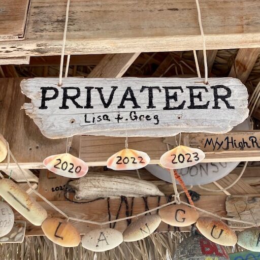
Mystic railroad BridgeMystic River Highway BridgeKrogen 52 Privateer at the dock
Once past the highway bridge you can talk with the dockmaster at the seaport and he will guide you to your dockage. There are multiple areas for docking, mostly all fixed. Some are actual docks, where we were, and some are sea walls. All have power and water and are in good condition. They provide fender boards if you need them.
Dockage is $4.50/ft for non-members and $3.25 for members. Mariner membership is $175. You can do the math, but for us, on a 55′ boat staying 3 nights, it was about a wash to join and get the lower rate, along with other benefits. If you stay 4 nights, the 5th is free, but the weather was about to turn so we stayed 3 nights.
The boats: If you like boats and are interested in our maritime history, then you will enjoy Mystic Seaport. Here are a few pictures of boats that I hope you will enjoy.
Restored rowing and sailing dinghysHenry Morgan
The Charles W. Morgan was a whaler in her time and is now one of the oldest tall ships still sailing. Fully restored by the shipyard, she last sailed in 2014. If they can collect enough money, she will sail again soon. (May I suggest reading, “In the Heart of the Sea, The Tragedy of the Whaling Ship Essex” by Nathaniel Philbrick. A facinating true story)
The Draken Harald
This reproduction of a Viking ship sailed across from Europe with a young friend of ours as crew. There is also a Viking exhibit that covers the Viking exploration of North America long before Columbus.
Hinkley Picnic boat
Ok, not part of the museum, but with her beautiful lines, might be there some day.
Another classic
A quiz for wooden boat lovers. Name her designer?
The Museum: The museum is a mix of exhibits demonstrations and working restorations. I will just describe a few here:
Watching the sails unfurled on the Henry Morgan was fun. After reading all of the Master and Commander series, it was enlightening to see how it is actually done. Of course this demonstration was while the ship was in port. I couldn’t imagine being aloft in a blow doing this sort of work. I like my electric winches and roller furling.
Sailors in those days received their first month’s salary in advance and had to spend it before leaving port on essential goods for the trip. They then spent the first month aboard broke. At the end of the month, on payday, they celebrated by “flogging the dead horse”. The scene was reenacted for us by the staff. The school kids got a kick out of seeing the “dead horse” dropped from the yard-arm into te sea.
the “dead horse” splashes into the bay
So maybe cleaning fish is not so interesting. But how people used to prep and salt cod is a significant part of our heritage. For many folks, it was the only source of protein in the winter. Salted cod lasted for years, looked like shoe leather, and tasted about the same. Still some dishes made from it today.
cod cleaning and prep
Tricky getting the last stave in place before the whole barrel comes apart. The cooper was one of the higher paid crew on a whaling boat. The blubber was boiled and the oil transferred to barrels for storage below deck. On the first voyage of the Morgan she returned after three years with a full hold of oil. The gross was $57,000. The owners got 2/3rds of that amount, the captain 1/12th, the cabin boy, 1/400th.
Barrel construction
The Mayflower II was built as a replica in the 1950’s and is in the restoration yard at Mystic.
Mayflower IIMayflower II receiving new planks
This next image gives you an idea of the work ahead of them. This section of the transom is rotted out and will be replaced with new white oak members.
Mayflower II transom section
Where are we?:
It is easy to forget how easy navigation is these days. After a visit to the ship’s instruments shop in Mystic I can begin to appreciate the skills and the daring of these sailors.
a log, or speed measuring tool
Dragging this behind the ship to determine its speed was a significant improvement over the chip log, just a drag device and a long line with “knots” tied into it. Not sure the paddle wheel log on our boat is much of an improvement. It rarely works.
Determining latitude with a sextant is not so difficult. A good sun shot will do. But to get longitude, sailors needed speed and time data, along with a noon shot of the sun. Not always easy. I will stick with my GPS.
By the afternoon of our second day we were both a bit tired so decided to take a tour of the river on the restored Sabino. One of the few coal-fired passenger vessels still operating. Captain Dave welcomed us aboard. For you Krogen folks reading this, Captain Dave is also captain of the Krogen, Calypso, which docks in Mystic in the summer and often in Stuart in the winter.
The Sabino
The engine room of Sabino is a piece of art. The engineer feeds the coal and oils the pistons. In the picture below he is looking at his watch, timing how often he oils the crankshaft bearins, I would guess.
If you want the full experience, here is a video of the engine in operation:
When we came up the river we had to wait a bit for the bridge. Even with twin engines and bow and stern thrusters, I was busy dealing with the tight quarters, the wind and the current. Captain Dave had only one steam-powered engine capable of maybe three knots. With no thrusters and no real throttle, he had to call down to the engine room for reverse, he calmly negotiated bridges and traffic and made it look easy. I was impressed!
Notes to future visitors: Coming by boat is a special treat. You get to walk around the grounds when the park is closed to all other visitors. Makes for special memories. If you can,
Morning before opening
come in the off season, before Memorial day or after Labor Day. If not, try for weekdays. Both the museum and the river can get pretty busy on summer weekends.
We got quite lucky with the weather and were able to make it non-stop from Florida to Newport. We went out at Cape Canaveral inlet on Thursday, 10 May at noon and arrived in Newport at midnight on Monday the 14th. In summary, 978 offshore miles in 108 hours for an average Speed over Ground (SOG) of 9.1 knots with an average through the water speed of 7.5. Highest sustained speed was11.5 knots, thanks to stream plus tail wind. Details and highlights follow:
(note: Privateer is a Krogen 52 trawler)
Planning phase: I plotted a route that stayed in the gulf stream (GS)as long as possible, entering just off the Florida coast and exiting just north of Hatteras. I had a few options planned for our offshore launch point once leaving Stuart, depending on weather. The sooner we could exit, the better use of the GS boost. I planned speeds based on estimated GS current in various legs and came up with 108 hours or 4.5 days. I used 1900 RPM and 7.5 knots speed through the water to get an estimated 9.1 knots SOG. This is our route superimposed over the GS. The GS file comes from the Navy. Also, just before we left, Chris Parker sent out cGS oordinates for west, east and centerline. I used these coordinates to update our route. We were able to stay in the stream until just north of Hatteras. While in the stream we adjusted for max speed and centerline by watching our crab angle. I estimate the GS speed between 2 and 3.5 knots. I plotted us to catch the west side of the large warm eddy off Cape May. We never saw a boost from it.
Image of the GS with our route superimposed
Weather forecast at departure: Using a mix of NOAA, Predict Wind, Chris Parker and Windy TV, it looked to be high probability to make it as far as Morehead City and 75% that we could round Hatteras but only 50/50 that we could pass Norfolk or Cape May due to a front offering 20-25 knots from the NE with worst case seas at 4-6′ on the nose. Over the previous 3-4 days the forecast between Florida and Morehead City remained fairly consistent, but the forecasts for the area north of Norfolk changed considerably every time i looked at it.
For departure, the weather did not favor entering the stream at Stuart, 10-15G20 from the NE would stack up waves on the nose. By Thursday the winds were predicted to clock to east, leaving a 2-3′ swell from the NE. Still not optimal for the GS, but manageable for a day as winds were predicted to clock to the SE, then SW with seas following around as well.
Day 1: We left Stuart at 0730 on Wednesday and stayed in the ICW to Melbourne where we anchored and enjoyed a quiet evening.
Day 2: Departed the anchorage at 0700 and followed the ICW to the NASA causeway, the NASA lock and the Cape Canaveral inlet. No issues here although the locking process is rather slow. We left the inlet at noon. We reached the stream a few hours later. Best description would be lumpy and confused. Mildly uncomfortable in the pilot house, fine below.
About 50 miles out I went below to do an engine check. When I got to the lazarette I happened to lift the floorboard to check the sump. About 2 cups of hydraulic oil. Not good. Loosing hydraulics would mean loosing the stabilizers which would mean an uncomfortable return to the nearest port, in this case, from where we left at Cape Canaveral. I cleaned up the mess and then watched for the leak to find its way to the sump. No more hydraulic oil. My first thought was, Yay! it fixed itself. But then I thought better and realized that never happens so continued the search. I finally found a leaky hydraulic hose leading to the servo for the stern thruster, which we had used in the lock but was now turned off. With the thrusters disabled from the pilot house there was no flow to the servo and therefore no leak. We were good to go.
Just as I was preparing to exit, I looked up at the flow meter for the hydraulic cooling water pump. Stopped! It was running fine just minutes before. I checked the hydraulic oil temp. and it was only slightly elevated. I had no idea how fast the temp would rise without water flowing through the heat exchanger but my first thought was that we would never make it back to Canaveral before it overheated. I just couldn’t believe that in the course of ten minutes I would face two failures that would force a return to port.
But wait! just two days before we left Stuart I had bought a back up cooling water pump for just such an occasion. The installed pump that failed was hydraulically driven, but I had purchased an electrically driven pump to make it easier to swap. I had also mounted the pump on a board and pre-attached a set of hoses. It took all of about five minutes to pull the hoses from the failed pump, attach the hoses from the new pump and plug it in. (Thankyou Kadey Krogen for putting 110v electrical sockets throughout the below decks areas.) I stayed below to watch the temp gauge and within a few minutes it began to drop back down. Here is a picture of the set-up:
Back-up water pump in action
So a couple of incredibly lucky happenstances, First, I was in the lazarette at exactly the time the pump failed, and second, after running the boat for nearly two years without a back-up pump I had just bought and configured the back-up. How about that for coincidence? When I got to Newport I removed the hyd. pump. Shaft had sheared at the impeller. No idea why. New pump in the mail.
Sheared shaft on impeller
Days 2 and 3: From the Florida-Georgia border, where the winds and seas settled down, to Hatteras, the weather and the ride were great. I was looking at buoy reports ahead of us and could see the wave heights coming down as we approached. We were averaging over 10 knots in the GS, with occasional bumps to 11.
Your Navy is out there: On Saturday night we were off Norfolk about 50 miles. Robin was on watch and called me up because a target ahead just didn’t look right. When I came up and looked, I had to agree. The target was reporting on AIS as “US Government Vessel”. Surrounding it were radar returns that looked like bees buzzing a hive. Anywhere from two to 6 returns at a time. Not sure what we were looking at, we adjusted course to create a two-mile point of closest approach. Just then we got a call from the vessel, this time identified as a “Warship”. Apparently two miles was not enough and the caller said three was the minimum.
By now we figured out that this was an aircraft carrier doing night carrier operations training and the “bees” were jets in the traffic pattern. Even from three miles out it was quite a sight. When we passed under the approach pattern the noise was impressive. Maybe a common occurence for folks who cruise these waters regularly, but for us it was exceptional.
Saturday Night: After the aircraft carrier show it was time to re-look the weather forecast for the final leg of the trip. We still had 10-15 knots out of the SW, down from the 15-20 knots earlier that day. Seas were down from 4-6′ to less than 3′. The forecast was for the winds to go Light and Variable as we passed through the trough, then come back from the NE on the back side of the front. The various forecast tools predicted a worst case of 15-20 knots from the NE and 5′ seas, but the average of all the forecasts came to 10-15G20 and seas 3-5′. all this for no more than 8-10 hours before reverting to S again. This was our last opportunity to bail out, and Cape May would be the landing point. Although Krogens don’t like short period head seas, we figured we could tough it out for a day or so since we could see the end of it. Did I mention the prediction for fog and a “chance of thunderstorms”?
Early Sunday Morning: I took over from Al at 0300 as we watched a show of lightning in the distance off the starboard bow. An hour in to my shift the band of lightning had expanded and intensified. The night skies were constantly lit up across the entire sky in front of me. The only thing I hate more than fog is lightning. Getting hit by lightning in a sailboat is not good. Could make for sailing with no electrical capability at all. But for a trawler, getting hit by lightning most likely will knock out the electronic engine controls. Dead in the water. (note to self: come up with some sort of plan to deal with this)
We have Serius Weather on the boat, which is not all that great, but it does provide a couple of valuable features. One is, we can get any NOAA text forecast. And two, we can get a convective activity overlay derived from NOAA’s lightening tracker. Since this data updates every 5 minutes or so I was able to track the storm even 50 miles out. I could see the west end of the storm lifting to the northeast so adjusted our course 30 degrees east to cut around the corner. (if you look at our track you can see the jog) After running this way for half an hour or so I was able to derive a more accurate track for the storm system and realized that I could return to course and the storm would pass to the east before I got to it. Within a couple of hours the storm had pretty much worn itself out and by sunrise the skies were clearing.
Day 4: By Sunday we had passed through the front and were facing 10-15G20 from the NE. This was kicking up a 3-4′ wind driven, short period wave on the nose. About the worst possible combination for this boat. Good news was, the prediction was that this would last only 8-12 hours. The ride wasn’t that bad but about every 5 minutes or so the wave pattern would lift the stern and drop the bow at the same time and she would bury herself in the next wave. A little wet and rather an unpleasant ride. We slowed to about six knots and the ride improved. That was our speed for the ext 12 hours which sort of messed up our average speed, taking us from an estimated 9.5 knots down to the actual 9 knots. It also put us back about four hours on our arrival time, eliminating any chance of arriving in Newport before dark.
I had been watching this weather for a week or so. Every day the forecast changed. On the day we left the forecast for Sunday when I estimated our position to be 150 miles south of Block Island , the forecast looked like this:
25-30 knots from the NE
This forecast predicted seas at 6-8′ from the SE, which might have motivated me to divert. As we left all I could hope for is yet another significant change in the forecast. I was checking this front daily as we headed north. And every day it changed from Go to No-Go. Luckily, by Sunday morning the forecast looked like this. Note that the winds are still strong like the week old forecast, but in the opposite direction. The arrow represents our projected location at the valid time of the forecast:
Frontal Passage wind Forecast for Sunday Morning
By noon on Sunday things were looking even better:
Sunday mid-day forecast with our projected location for the valid time of the forecast
By Sunday evening the forecast continued to improve for the area south of Long Island. It appeared we would be out of the adverse winds and seas by some time late Sunday or early Monday. Note that the southerlies we had passed through on Saturday had strengthened as part of a stationary front to our south. This front slid north but at a speed less than ours. Just good we got passed Hatteras when we did:
Things that go bump in the night: There are nets and traps of all sorts along this route. In the GS we saw many fishing buoys riding the current. Some of them transmitted an AIS signal with a name and their battery voltage. Apparently a mother ship tended the buoys and replaced the batteries. And also apparent, she was behind in her duties. We saw many buoys that were no longer transmitting. No idea how many we passed after nightfall. I wonder if there is any controlling government body that regulates this? Or can just anyone throw out traps? Who knows what the safe distance might be.
A 100 miles south of Long Island I once again (been here often) crossed over strings of buoys apparently holding up nets since they run in a long line. I have always assumed I could pass between them, but thats just a guess. So far I have never fouled on anything. These buoys have radar reflectors so are actually easier to see at night. Here is a shot of our radar showing the returns. Sorry about all the reflections.
a two mile long string of buoys supporting fishing nets
Day 5: By Monday morning the wind and seas had subsided and we were back up to 1900 rpm and 7.5 knots. That put our arrival time at about midnight. Weather predictions for fog were dropped from the NOAA text and things were looking good. I don’t like arriving in port at night, and really don’t like doing it in fog, so the improved forecast was reassuring. Not!
We passed Block island around 8 pm, too late to divert and anchor in daylight so pressed on for Newport. There are a few anchoring options short of our marina so I had some options if I decided not to go all the way into the marina. Our marina, Coasters Harbor Island Marina at the Navy base, is just past the Pell Bridge. The basin itself has some ambient light but the path in is rather convoluted, with some rock ledges, unlit boundary markers, crab pots and the like.
Arrival: By 10pm we could see the lighting on the Pell bridge. And then the bridge disappeared completely in the fog. One by one all of the shore lights went out, followed by the lighted navigation buoys. Even the one just a 1/4 mile away. This was just the double whammy of night and fog I was trying to avoid.
Short of Newport harbor itself, there is nowhere to anchor, except Point Judith harbor of refuge. Not a bad option but requires passing through a narrow breakwall and then sorting out anchoring room with other anchored boats. At night and in the fog. Short of going all the way to the marina, the anchoring options were; off Goat Island which is pretty deep and not protected from the 20 knot southerlies we were seeing,and a spot just past the Pell bridge and to the left. Our marina is to the right. The approach to the marina is from the left, under the bridge and between “GR” red/green buoy and “Green C7”. Our slip for the night was the deepest “T” head.
Coasters Harbor Island Marina. US Navy Support Base in Newport
I decided that we would go anchor just past the bridge and come over to the marina in the morning. Using radar and nav software, coming up into Newport harbor was not too bad. When we got within a 100 yards or so of the channel markers their light would penetrate the fog in a reassuring sort of way. Passing under the bridge was eerie in that the reflected down lighting from the street above created a dark wall in the fog beyond the bridge. It looked pretty solid to me. With crew out on the bridge we crept forward.
Once under the bridge I was prepared to turn left to the anchorage but I could see the lights of the buildings at the marina, as well as the single green channel marker at the entrance to the turning basin. Might as well go in. We had one crew backing me up on nav and radar and another with a search light picking up the bouys marking the reefs and the crab pots. I have been in and out here dozens of times, but it had been nine months since we had left so I was a little concerned about remembering all the turns. But at 2 knots we were able to work our way in with enough visibility, knowing we would be the only ones out here.
At the dock we received a less than warm welcome from a couple of security guards. This is a secure facility and they had no way of knowing who we were. Few boats come in here after dark, let alone at midnight in the fog. But once they saw some ID they were fine.
Tied up at just past midnight, we broke out the Privateer label special rum and toasted a great ride north.
Many thanks to my crew, Alan Williams and Robin Ricca.
A note on sources of weather data before and during the trip: Prior to departure I had all the bandwidth I needed for forecasts. About seven days out is as far as most forecasts go. GRIBS are available out seven days, but not really worth much. NOAA text forecasts are usually just five days. Big picture NOAA weather charts help somewhat as major fronts can be observed as the cross the US from west to east.
Since the trip was planned for five days, the forecasts revealed themselves as the departure date approached. But it wasn’t until the day of departure that I could see much on weather near our arrival area five days out.
Offshore I had a number of ways of getting weather. Sirius satellite weather provided access to all NOAA text and thunderstorm tracking. But the GRIB files only go out 48 hours. Weathernet by Ocens uses our Iridium Go to provide most any NOAA product to include all text files, GRIBS, graphical charts and buoy reports. A little clumsy but the only app I know of that can do all this. Getting buoy reports of winds and sea states 100 miles ahead was invaluable.
The Predict Wind app also interfaces with the Iridium Go and provides GRIP reports from US and Euro models as well as their proprietary models. For this trip I found the US model, GFS, to be the most accurate, but that has not always been the case in the past. Predict Wind is usefull because it moves a boat symbol along the projected track in conjusction with time so if I am looking at GRIBS three days out I can see about where the boat will be.
Last but not least is the Chris Parker daily email, also received via the Iridium GO. These reports are detailed and the most accurate I have ever used. He adds an experienced human to interpret multiple models as well as all the NOAA forecasts. If I had only one source of weather it would be the Chris Parker reports. For the US east coast, he organizes the wind and seas forecasts to align with a run up the coast; Saturday off Hatteras then Sunday off Cape May, for example. He also includes sea state, wave direction and wave period. All valuable for determining g0o, no-go decisions.
Finishing up maintenance tasks at Sunset Bay Marina in Stuart. Now on a road trip to Tallahassee to attend Grayson’s graduation from FSU. Back to Stuart on Monday and hoping to launch on 9 May.
I would like to make the entire trip on the outside. 5 days and done. To that end, Lisa will drop out and a couple of friends will come aboard. Lisa is good for one or two nights out in settled weather but is not fond of bouncing around in the Gulf Stream at night. Better she let us do this and relieve me of having to duck in to port before I might otherwise.
I will update this post every day or two and see how the weather evolves over time.
4 May Look:
As the departure date approaches, I can begin to see how the weather is going to play. The Florida coastal weather will likely force us into the ICW if we leave on Wednesday, or we can delay till Thursday and go out. Wednesday Winds N15G20kns with seas 5′ from NE. Not the conditions I would choose for a Gulf Stream ride. Would even make exiting St. Lucie inlet a bit dicey. But the 9th is still a ways off and the forecast models are not particularly accurate with a series of troughs in the area.
By Saturday, 12 May the winds up around Hatteras turn North, which would force us in to Morehead City if we do go out. But if we wait till Thursday we will not be able to get into Morehead City before the winds shift North.
If we leave Wednesday and go up the ICW, we will stay in the ICW till St. Augustine or Jax. That would be three days; Stuart, Melbourne, Jax. Then out.
Lets give this a day or two and see what develops.
5 May look
What a difference a day makes. On our departure date, 9 May, the winds are still a bit contrary to the stream, but at 11 knots, tolerable.
Meanwhile, we are just now getting the NOAA coastal forecast for Wednesday, 9 May. This is a snippet for 20 miles out:
Tuesday
Northeast winds 5 to 10 knots. Seas 4 to 5 feet. Chance of showers.
Tuesday Night
Northeast winds 5 to 10 knots. Seas 4 to 5 feet. Chance of showers.
Wednesday
Northeast winds 10 knots. Seas 4 to 5 feet. Slight chance of showers.
Along the coast the seas are a little better:
Wednesday
Northeast winds 10 knots. Seas 3 to 5 feet. Slight chance of showers.
This is about my max for wind opposing current in the stream. And I don’t like the seas. But the seas referenced in the NOAA forecast are for the swell from the east, across our beam,not the wind driven wave from the NE, but NOAA doesn’t bother with those details. Regardless of these hair splitting issues, it will still be rather uncomfortable on Wednesday if the seas really are 5′. I will watch this closely.
But by the next day, everything clocks to south of east.
After this, the weather stays mostly favorable. Some stronger winds and higher seas, but from behind us, plus one mild trough to pass under off Hatteras, of course. All in all, doable. But I am sure this will all change before we leave.
6 May Look
Some improvement here and there. WindyTV shows a little less wind on the afternoon of Day 1 off Canaveral. This is probably the roughest sea state as it is wind opposing current in the stream. 10-15kts from ENE, not too bad.
The NOAA coastal is a bit better as well. A few 3’s and no 5’s:
Wednesday
Northeast winds 10 to 15 knots. Seas 3 to 4 feet.
Wednesday Night
East winds 10 to 15 knots. Seas 3 to 4 feet.
Thursday
East winds 10 knots. Seas 4 feet.
Thursday Night
East winds 5 to 10 knots. Seas 3 to 4 feet.
Friday
East winds 5 to 10 knots. Seas 3 to 4 feet.
Once these seas settle down we are OK till N of Hatteras, then some stronger winds override us from the south. A sleigh ride to the finish.
So at this point I am leaning towards going out immediately at St. Lucie (Stuart). Should be somewhat uncomfortable till Thursday morning, but then OK from there. Still a few days to let all this settle out, but so far, I like the trend.
8 May look
Looks good. initially lumpy in the stream off Florida, then goes L&V near Georgia. Short busts of N wind but nothing significant till we get near Long Island Saturday night and Sunday. This weather event is from the south, so no big deal, but it is arriving sooner and trend shows it getting stronger so will have to watch closely.


You must be logged in to post a comment.