Our first mistake was trying to meet a schedule. Having plenty of respect for the conditions possible off the Jersey coast, we normally err on the side of caution. This year, because we had commitments that kept us in Newport till Thursday evening, and plans that required we be in Annapolis by the following Tuesday, we bet on the weather. And by that I mean, we bet that the forecast would be accurate because as it stood, the forecast was on the cusp of a no-go. Not to bad… but not too good either.
The route is displayed below. To go non-stop, about 30-35 hours, requires some lucky breaks on the weather. Northerly component till you turn up the bay, then a shift to southerly. But not too strong, as wind against current in the bay can be nasty.
As of Thursday afternoon, with a departure planned for Thursday evening, this was what the GRIBS forecast (and NOAA agreed),
WINDYTV as of Thursday Afternoon
As you can see, winds were predicted to be rather strong Thursday evening. We planned to pass Block Island around 11pm, duck under the lee of Long Island until 2AM or so, the continue south as the winds eased. We planned to be turning up the Delaware Bay by 8PM on Friday.
With a forecast of 3-4′ seas south of Block Island, we expected a few 5 and 6′ seas, But with the wind and seas from behind us, we weren’t too concerned. As long as the forecast held. And with a little luck, actually a lot of luck, the winds would turn favorable for the trip up the bay.
Had there not been events driving our schedule, we never would have left with this forecast. Not that it wasn’t doable, it just had no margin. And that is what did us in.
By the time we rounded Block Island the winds were steady in the low 30’s, with regular gusts in the 40’s. The max we saw was 47 knots. Abaft the beam, mostly, but still rather impressive at night, since the sea state matched the wind speed. I won’t guess at the wave heights, since it was really, really dark, but we were regularly burying the anchor in the next wave. Boat was fine, crew, not so.
We gave up on ducking under the lee of Long Island, since we would be too close to the wind while trying to get there, and decided to just run downwind till it blew itself out. The forecast showed that by the time we got 50 miles or so south of LI, about 5 am, we would be in moderate downwind conditions. We just needed to keep our speed up until we turned up into Delaware bay, as the next front was not far off.
Two things happened to thwart that plan…. The norther was late to leave, and the southerly blow came early. We got about two hours of L/V before we were getting 20-25 knots on the nose. Funny how seas take forever to settle down once a front passes, but how quickly they build when a front arrives.
So now we are 3-5 hours late to our turn up the Delaware bay, and the southerly blow is 3-5 hours early. We are off Barnegat at 5 pm or so, and could make it in before dark, but I have never been in there before, the current would be opposing the wind, and if we did go in, we were likely to be stuck there for days. No thanks, on to Atlantic City!
Atlantic City has a few things going for it. A really good all weather inlet (we have used it before) and there are lots of lights. Bad thing is, we are going to the marina area and have never been in there before, day or night. And I don’t like to enter harbors at night for the first time.
So now it is 6 pm or so and Lisa calls Kammerman’s Marina, asking about space. They say they will hold a space for us on the fuel dock, and we give them a 9 pm ETA. Meanwhile, the weather deteriorates a bit. Now its 25G30 knots and 5′ seas with about a 4 second period. That will slow you down. Our ETA grows to 10 pm.
We make preparations for entering the inlet and finding the marina. The outer buoys are lit, but I know some of the inner marks are not. We have a flood light on the mast that will at least highlight a reflective buoy, and a really powerful searchlight. But the entrance to the marina area, a left turn out of the inlet, is a bit confusing.
Bouys 2 and 4 mark the route into the marina basin
The bifurcation buoy marks the choice between continuing further down the inlet or entering the marina basin. It is lit, but the RED 2 is not. And the RED 2 is about 2′ high and up against the bulkhead. I know now that the route is between the RED 2 and 4 and the bulkhead, but at 10 pm, after 28 hours of bashing into waves, the route is not so obvious.
As we approach, we can see a green lighted marker, but its hard to tell if the light is the bifurcated mark or the green mark just beyond. Meanwhile the current is helping us move faster than we would like. Thanks to some good searchlight work by Lisa, we spot the RED 2, and after that sighting, following the buoys the rest of the way in is not too difficult.
Once in the basin we try calling Kammerman’s, and would you believe it, Chris Kammerman, the owner, is there at 1015 PM to guide us in to the dock and tie us up. Just doesn’t get any better than that. Thankyou, Chris.
We take a lay day in AC, winds are still howling out on the coast. The next day things look much better, so being experts on night arrivals, we do a night departure. And the currents in the bay are timed perfectly.
I have mentioned this in previous posts, but northbound in the Delaware Bay, slack tide walks up the bay, so heading north, even with our slow speed, we can travel with great current the entire way. There is a great NOAA planning tool called Delaware Bay Operational Forecast System (DBOFS). No new data here, but the animation and visualization is very helpful.
DBOFS
The rest of our trip to Annapolis was uneventful. Spent a quiet night at Schaefers. Left mid-morning in rain and wind to make some progress south towards Annapolis. (remember, we have a schedule to keep)
Just one more comment. As we headed down the upper Chesapeake, winds were in the mid 20’s, gusting low 30’s. Looking for somewhere to anchor for the night. Too far to make it all the way to Annapolis. Chose Handys Point/ Worton Creek entrance because it was rather high sided to the north. Amazing the way the low cliffs and tall trees blocked the wind. Winds were below 10 knots. A gust now and then, but not enough to move the boat. Meanwhile, just around the corner the bay was a mess. We slept well and moved into Annapolis the next morning. On schedule. Bad captain.
When the stories about COVID-19 first reached us in February, we were enjoying life at Cambridge Cay in Exuma Park. China had an issue, but the US hadn’t reacted as yet. As park hosts we organized one of many sand bar happy hours, not realizing that it would be the last time we would be within six feet of another human.
Our last sand bar happy hour, Cambridge Cay, Feb.
Even after COVID-19 reports on cases in America reached us, the problem seemed so distant. We figured we would be fine if we just stayed where we were. Pretty much socially distanced (other than the happy hours!) without really trying very hard. But as we learned more, we realized that even in the Bahamas we weren’t necessarily safe. The virus would get here sooner or later.
Then the first confirmed case of the virus showed up in Nassau and everything changed. Overnight Exuma Park “closed”, meaning moorings and anchorages were available, but visitors count not enter the headquarters office. Payments had to be made online and moorings were assigned by VHF radio. Rumors of what might happen next in terms of closings and expulsions of foreigners were disconcerting. We needed to decide if we were going to stay in the Bahamas for the duration or come back to the US. If we did come back, where would we go?
Everyone’s situation is different, but we decided to leave the Bahamas immediately and get back to our home port in Newport, RI as quickly as possible. We did not believe we had been infected in the Bahamas and planned to practice social distancing while we traveled. We were concerned that if we did get sick at some point prior to getting back to Newport, from the virus or anything else, we we would be at the mercy of either the Bahamian medical system or some stateside ER facility. And we both have non-serious, but chronic medical conditions that need somewhat regular medical intervention. Difficult to handle these issues away from “home”. And hard to shelter in place when we are full time liveaboards with no land home. So, right or wrong, we chose to travel back to Newport, or as close as we could get.
Our plan was to anchor out as much as possible, using marinas only as necessary for fuel, provisioning or to hide from bad weather. There are also a few places on the ICW where decent anchorages are few and far between and a marina is much more efficient for maximizing distance traveled per day. We were hoping to find some good in all this, checking out as many outdoor nature areas as possible.
Our normal route from the Bahamas to Newport is mostly offshore in a two day hop to Charleston, SC and then to Morehead City, NC. We usually travel inside on the ICW from Morehead City to the Chesapeake Bay, then offshore to Newport. But the weather gods were not favoring that approach so we ended up in the ICW from Ponce Inlet, FL to our current stop here at Patuxent River, MD. The remainder of this post describes our route, our overnight stops, and some unusual encounters. I have added some lessons learned and tips for how to improve on social distancing.
First, about the ICW. Lots of shallows, especially in SC and GA. Nothing new for you ICW regulars, but we have not been down here in quite a while. And it was our first time in some areas. We used Bob423’s book, supplemented by the latest US Army Corps of Engineers hydro data as displayed on AquaMap Master. Bob’s book is great, but even the latest 2019 edition is a bit out of date regarding some of the ever changing shoaling. Using the latest USACE data, there are areas that have been dredged since his publication date (Yay!), and areas that have shoaled(Boo!).
Prior to the trip I downloaded Bob’s routes to the boat’s nav system as well as to AquaMap on the iPad. When we came up to a shallow area with a Bob423 route, I drove the route and Lisa followed the boat on the iPad. She had the latest USACE bathy data and would tell me to divert left or right for better water. In every case, Bob’s routes from 2019 are still good. In some areas Lisa was able to find an additional foot or so of depth based on updated bathy data.
The next source of valuable information was Waterway Guide’s web page on COVID 19. There we could find lists of open and closed marinas, as well as local government regulations regarding boating in that state, city or town. Some marinas listed on the site had subsequently closed, but the info was helpful. More for which marinas were already closed. I will not bother to discuss the various state by state guidelines as they are changing as we speak.
Our first leg was from Great Harbour Cay, Bahamas overnight to Port Canaveral, FL. As we were leaving, that marina was putting restrictions on new arrivals. Since then, all of the Bahamas has been in some sort of lock down so I will not attempt to capture current conditions there. But from what we have heard, leaving was the right decision for us. The Bahamas have a difficult problem as most of their GDP comes from tourism. And that means cruise ships. The Bahamas was a little late in stopping entry via cruise ship but has done that, as have other countries. Meanwhile, lots of empty cruise ships, many registered in the Bahamas, are floating around without a berth to go to. In our run from Great Harbour Cay to Port Canaveral we saw twenty-nine cruise ships at anchor or docked. There were nine parked just off Great Harbour Cay.
Cruise ship parking lot
The trip over was quite comfortable. Should you follow this route, which dips under Grand Bahama, note that quite a few ships loiter outside Freeport waiting for their turn. Most of them are stationary but can start up at any time and head off in any direction. Better handled in daylight.
Tankers floating around waiting for a berth
Our US arrival was uneventful. CBP ROAM app worked well and we were cleared while still a mile offshore. Talking to the dockmaster at our arrival marina, Ocean Club, he mentioned that folks not using the CBP ROAM had some difficulty clearing into the US. We have not heard of anyone not being able to check back in using ROAM. I will mention that we have had to update the ROAM app a few times so if you are planning to use it soon, check to be sure it is the latest version, and your data, such as your customs sticker number, is up to date.
We have stayed at Ocean Club a few times. Nice facility. We took on 1,000 gallons of fuel at $2.50/gal, plus one night’s free dockage. There are better prices out there now. This was our first attempt at coming to a marina while practicing social distancing. I let the dock hand pass me the fuel hose, and Lisa went to the office to sign the credit slip. In both cases, we kept our distance but we realized we could have done better. So:
Tip #1 is, have the dock hand set the fuel hose down near the boat and walk away. Then, wearing gloves, handle the hose yourself and put it back on the dock for him to recover.
Tip #2 is, pay the bill by providing the credit card number over the phone. We used this at St. Augustine, FL to pay for our mooring and again at Thunderbolt, GA and never left the boat. We also used the Dockwa app at Barefoot Marina in Myrtle Beach, SC which eliminates in person payment altogether.
Back to our trip North. Note that at the time, the Canaveral Lock was closed for maintenance. Reopen date might be 30 April. Since the canal was closed, we went outside to Ponce Inlet. We talked to Tow Boat US before going in, our first time here, and their instructions were straightforward. Nothing less than 7ft MLW. Our anchorage for the night was Bethune Park, just south of Daytona.
Bethune Park
There was plenty of room. Only three other cruising boats. But much of the area is used up by local boats on moorings or semi-permanent anchors. We entered at R44. There are some 5ft humps in the area so keep alert. We anchored in the far north end. You can go further into the pocket in the NE corner than the charts would suggest. New city dock being built, with small beach near by if you need to walk a dog. Note that Halifax Harbor Marina, just to the north, was closed to transients at the time. Next time I will anchor just inside R44.
Next stop was St. Augustine mooring field. You can reserve a ball on line and pay by phone. We called a lay day for weather but did not leave the boat. Perfect for social distancing.
Trying to make the best of a difficult situation, we looked to find ways where we could enjoy some of the natural beauty of the area while following the guidelines. To that end our next destination was Cumberland Island National Sea Shore. At that time, the park offices were closed but park access was allowed. This is no longer the case. The island is now closed with signs posted to that effect. At that time we did see a few other people, all arriving by private boat as the ferries had long since been cancelled. For the most part, we had the park to ourselves.
Walking trail at Cumberland Sea shoreAnother trailFeral horses run looseLisa invites some of the locals to happy hour
There are multiple anchoring options at Cumberland, even with the island closed. With winds from N through SE, you can snuggle up pretty close to Cumberland Island. Tall trees will block most all the wind. No ferries to bother you, but still some runabout traffic. I sounded the area with the dinghy and the shore is deep nearer to land than the charts indicate, at least in the areas between the park docks. We came in with a SW wind so anchored in the middle. We like lots of space around us and we got it. Some protection, at least from fetch, can be had behind Drum Point Island on the western side of the anchorage.
Note that the new anchoring laws in GA prohibit anchoring within 1’000′ of any public or private dock, etc. So if you obey this law, you cannot anchor anywhere near the park docks. By the way, GA law also requires a lock of some sort of holding tank overboard pump out. See the latest at: https://coastalgadnr.org/new-coastal-boating-laws-take-effect-georgia
Our next stop was the Wahoo River in Georgia. Mostly open marshland with one area of trees providing North protection. We declared another lay day so we could explore the tributary creeks by kayak. The creeks cut deep, narrow and winding paths through the marsh grass, providing cover for all sorts of wildlife. Plenty of signs of alligators, and we could hear them bellowing from the cover of the grasses, but we never did see one. Lisa was happy about that!
Privateer on Wahoo River
This was our second time to use this anchorage and both times were in settled weather. The current is a knot or so on the ebb tide and barely noticeable on the flood tide. About 20ft deep so it took a bit of chain, but the deep section is at least 400ft wide, so plenty of swing room. I think it would work fine even in strong winds because the holding is good.
A bit of weather headed our way, so our next stop was Thunderbolt Marina near Savannah, GA. Never got withing six feet of anyone. Another lay day as we waited for the weather system to pass. Face dock directly on the ICW, so easy in and out. No provisioning within easy walking distance.
Steamboat Creek, SC was our next stop. Just past the Watts and Dawho shallows. There are a number of excellent anchorages in the area. Steamboat is wide and deep but has areas in of 15-17ft depth, so less anchor chain needed than other spots. Mostly exposed, but south and west wind protection available if you go further up the creek. If you choose to stop prior to the shallow sections, there are some nice stops on the South Edisto River. And again, you can find wind protection from whatever direction by choosing how far in you want to travel. Steamboat has a dock for dog walking. See Bob423 info for the exact location. Good holding and plenty of swing room. Some crab pots but easily managed. Pretty sunset in a peaceful spot.
Awendaw creek was next. Just a wide spot in the creek just off the ICW, but the widening helped reduce the current. About 1.5 knots on the ebb, less on the flood. Pretty setting but no wind protection. Good holding, plenty of swing room and just a few crab pots to avoid. No place to walk a dog.
Not looking forward to transiting the Rockpile for the first time, we chose to stop at Barefoot Marina, just short of this hazzard and face it fresh the next morning. Another face dock directly off the ICW so easy on and off. Paid over the phone and never left the boat. I suppose the Rockpile was easy, as I didn’t hit the rocks. But did I miss them by twenty feet or 2 inches? I will never know. Some day we will go through at low tide when you can see the rocks. That might scare me even more. Just a couple of miles long, but still scary.
We anchored next at Banks Channel in Wrightsville Beach, NC. Our hope was that we could travel offshore the next morning to Cape Lookout and visit the National Seashore. But again we were turned off by the weather to come. We anchored as deep as you can go in the pocket, near the low causeway bridge. Nice with no crowds, but this place can be pretty popular during normal cruising seasons. We were almost alone. Some weirdo in a small sailboat on a home made mooring decided to leave without dropping the mooring line at dusk. Under full power he did three or four loops in front of us as the mooring first dragged and then grabbed. He finally gave up and collapsed in a drunken stupor, with his boat sitting on top of our anchor. So now what? We decided to pull anchor quickly as it was already nearly dark. At the same time we called the local US Coast Guard to report the guy. We thought he was adrift as he appeared to disconnect from the mooring just before passing out on the bow. The CG arrived as I was dropping the anchor in our new spot. They had talked to the guy and then came by to tell us there was nothing they could do, since they did not witness the event.
More weather in store, so our next stop was Caspers Marina in Swansboro, NC. Again, an easy off and on to a face dock near the ICW. With 2-3 knots of current, it runs parallel to the dock so not so bad. Never got off the boat and paid remotely. I did hand the dock hand a tip, so violated a bunch of distancing rules. So here is the next tip;
Tip#3; prepare a few baggies with tip money in them now. By the time you need them the virus, if there was any, will be non-viable. Pass the baggie with gloves on. Both you and the recipient are relatively safe.
Krogen Bay Wolf leaving the dock just ahead of us at Caspers Marina
Bonner Bay, NC, just above the Neuse River, was our next anchorage. Large open bay, without much cover, but the weather was supposed to be benign so what did we care? We set the anchor, but I settled for 6:1 scope, since the night was promising to be quiet. And you know whats coming… When the storm came over we got a 180 degree wind shift and about 35 knots for 20 minutes or so. When I looked at my plotter I could see that we had dragged about ten feet with the wind switch. We had 500ft clear around us so no big deal, but still a bit disconcerting. If you go there, you can move deeper into the bay for some protection from SE to SW. Of course our weather event came from the North. And none of it was forecast.
Speaking of not being forecast, we were underway nearing Belhaven, NC and a cloud bank rolled over us. With that cloud bank came wind gusts to 50 knots. Sitting in our Krogen, all warm and fuzzy, it was more a novelty than a serious problem, but still impressive. A new record for us, even after lots of offshore sailing.
Had an interesting experience west of Morehead City, NC. First saw a lot of fish jumping near the boat. On closer look as we drove through one school, they were rays. Then they started swimming into the props, over and over. The boat shuddered with each chop of a ray and it was happening every few seconds. We slowed way down to reduce the potential damage but not sure that helped. There was some current in the area, so we could not just stop. This went on for at least a mile. Bad day for the rays.
Again we had a forecast for overnight thunderstorms, so we went to Alligator Marina, NC. Long face dock, easy turning basin, and no current. We were placed on the outside end so were able to leave at first light for the 70 or so miles to Atlantic Yacht Basin in Chesapeake, VA. Note that there is a 6ft hump just as you enter the breakwater at Alligator. No big deal if you know it is coming. Our intent was to get across Albemarle Sound before the wind picked up and we just made it. By the time we got to AYB, it was gusting 40 knots in the cut itself. I had planned to top off our tanks with cheap fuel at $1.98, but couldn’t bring myself to perform two docking sequences in those winds.
We chose AYB as a stop because there is easy walking access to a Kroger grocery store. This was our first provisioning stop since Port Canaveral three weeks back. We really wanted some fresh produce. We had enough canned food and sprouts to keep going, but figured we could risk a stop.Virginia isn’t one of the stricter quarantine states so plenty of people about, some with masks, some without. Lisa donned mask and gloves while I waited outside to help carry the stuff back to the boat. Note that while we were there, AYB instituted a three day maximum stay for transients boats. They said they need dock space to launch their winter storage boats. From the looks of the dock, I am guessing that some transients have chosen AYB as an interim shelter in place location. Easy access to shopping, protected marina, etc. By the way, plenty of room on the free town docks. South town dock had a few boats and north town dock was empty. There is a twenty-four hour max stay rule.
We are now at the Pax River Navy Marina near Solomons, MD and this is our interim destination. We will shelter in place here while we wait to see what happens in Newport, RI. The last day on the Chesapeake, mostly in Maryland was quite strange. We saw only one or two small fishing skiffs and the bay was otherwise deserted. Yes, it was Easter Sunday, but still? The ban on recreational boating is being adhered to. We did see one small sailboat coming out of Solomons, but that was about all.
Our marina at the Naval War College is scheduled to open on May 1, but recent declarations by the Governor of RI have put a bit of a wrench in things. All boats entering RI from out of state must quarantine for 14 days, fly the Lima signal flag and stay aboard. We can handle all that but I am not sure our marina has figured out their procedures. In any event, when we leave here, we will be sure and have plenty of provisions aboard.
In summary, everyone considering the trip north will have to judge for themselves whether it is safe for them, and for others, to be on the move. We did the best we could to maintain our self quarantine and practice social distancing when we needed to interact with others. There were a couple of instances of interaction that could have been avoided if we had thought it out in advance and those are captured in the Tips.
As to the ICW. Freakishly empty. Open marinas had space and anchorages are mostly deserted. We had no issues with any law enforcement, just smiles and waves when we did see anyone official. I don’t think cruisers returning home are the target of some of these rules, but we may be caught up in them. The Maryland edict was brought on by boaters not following social distancing, etc. But the Rhode Island edict that forces a quarantine on all boats coming in from out of state (think NY and CT) hits us directly. Luckily RI is easy to avoid if your destination is further north, but will be a challenge for us. We will be sure to arrive with plenty of food, beer and wine.
Below is a listing of our stops, with the approximate mile markers. Hope your trip goes as well as ours did. Now we just hope we can get back to Newport!
George Town on Great Exuma in the Bahamas is a popular cruiser stop on any trip through the Exumas. Whether you stay there for the season or just pass through, George Town provides weather protection, a decent grocery store, free water and maybe more company than you would prefer.
We have stopped there many times over the years and always enjoyed it. A conch burger at Chat and Chill, washed down with a few Kalicks is sort of a must do stop for us whenever we pass through. While we have enjoyed the beach time, snorkeling and hiking on Stocking Island, we have never done much land travel on either Great Exuma or its southern sister, Little Exuma.
Northbound travel brings you past the airport, Sandals resort, Emerald Bay marina and generally well developed areas. Southbound is somewhat more rural and brings some interesting local culture to light.
Easy Riders
For our first adventure south we rented this motor scooter. We figured easy, fun and cheap. We figured wrong. It cost $50 when a car would have cost $80. While I used to ride when younger, handling a scooter is not like a big road bike, and having the extra rider behind me was a bit of a balance challenge. And while the roads are generally decent, there are many pot holes as deep as the little tires are high. Hit one at 30 mph and its all over. So that fear had my eyes glued to the road the entire trip. Regardless, we decided we would come back with better wheels and maybe even a guide.
On our next visit to George Town we were excited to hear about a guided tour south being arranged by one of the cruisers, thanks to Mark on CAVU. This tour would be guided by Cordell Thompson, a local Bahamian who traces his history on Great and Little Exuma back to the 1700’s. We had actually met him a while back when he was giving a talk on vollyball beach on bush medicine and home remedies. He turned out to be a wealth of knowledge about the island and its people.
Cordell with keel
Local Bahamian boat building is a fascinating story that goes beyond what I could cover here. But the sailing hulls they build, all out of local wood and all with 100% local materials and labor, are things of beauty. watching them race is as entertaining as it gets down here. In this picture, Cordell is holding a piece of mahogany with the correct grain pattern for what will become part of the keel of a racing slop.
Slave Plantation Ruins
We had to push through a fair amount of underbrush to get to the site of this former cotton plantation. British loyalists from the US were transplanted here, along with their slaves, after the revolution. This lasted until the 1830’s when slavery was abolished in Britain and all of her colonies. Many of the current population of the Bahamas can trace their ancestry to Loyalists (white) or slaves (black). We found it interesting that places like this plantation, with so much history, are left to crumble. Cordell said the attitude towards these sites was somewhat indifferent. And of course, there is little money available for such things when hurricane damage from two years ago is still to be repaired. (see our blog on the Ragged islands and Duncan town.
Some day we will come back and sit with Cordell to learn more. Comparing how the US recovered from slavery to how the Bahamas handled it would be interesting.
Mom’s Bakery
On a lighter note, here I am spooning on extra helpings of rum sauce on Mom’s famous rum cake. This is the real reason we made a second trip to Little Exuma.
Well its nearly 5 pm and I have a 24 hr cellular access that is just about to run out, so this is all for now. If you have a few extra days in George Town, we recommend a trip south.
We did a quick run up the Ragged Island and Jumento Cays chain. By this point we had been gone from the Turks and Caicos for a week and were somewhat overdue to clear Customs and Immigration back in to the Bahamas.
The chain runs for about a hundred miles, has more than a hundred islands, and has fewer than 100 people. They all live in Duncan Town at the southern tip of the chain.
Duncan Town is the little settlement that could. Exposed at it is, on one of the higher points in the Bahamas, it has been devastated by hurricanes most recently, Irma. Being a long distance from Nassau, the money to reconstruct has been slow to appear. And now the more recent devastation in Abaco is spreading rebuilding funds even more thin.
The police station has yet to be repaired, along with many other structures in town. But work has begun on a new school and a solar power plant.
We took our dinghy up the long mangrove channel to the town dock and walked up the hill to town. Signs of rebuilding were everywhere but with a long way yet to go. We had a nice lunch at Sheila’s Fisherman Lodge and met Adrian who rode out the Irma in a house that was mostly destroyed. He told us about having to leave that house as it was being torn apart by 200 mph winds and escape to the neighbor’s house still standing. Hard to imaging what it was like, as the house that was destroyed by the hurricane was built with thick walls of stone.
The Raggeds raw beauty and nearly unoccupied land and water suggest what the Exumas must have been like many years ago. Spectacular beaches, clear water and white sand anchorages make for a nearly perfect cruising ground. I say nearly perfect as there are few places to hide from a significant cold front. The few other cruisers we ran into down there all knew each other – group of hardy sailors that return every year for a little relaxation and camaraderie at the Hog Cay Yacht Club.
DCIM\101GOPRO\GOPR3039.JPG
After a five days in the Acklins and a few more in the Raggeds we would have enjoyed some company at the “Yacht Club” but we were the only boat anchored in the bay. We sat through yet another minor weather front but this time our anchor was well set. After diving on this set I was beginning to really appreciate the Raggeds.
How an anchor should look
We hiked across to the windward side of the island and enjoyed some great views. Also enjoyed a nice sunrise before moving north.
Sunrise at Hog Cay
By now we were ten days out of Turks and Caicos so decided to get back to George Town to clear in at Customs & Immigration. The shortest route is through Hog Cay Cut (a different Hog Cay) but it looked a bit tricky so we took the long way around. That did provide for some very pretty motoring across white sand banks. About ten feet deep but we could count the blades of grass below.
A cruise through the Bight of Acklins definitely qualifies as remote. We were there for five days and never saw another boat of any kind. We went ashore one day and barely found anyone there either. Since the population is only about 500 that is understandable.
We left Provo, Turks & Caiscos, midday and rounded Castle Island at the southern tip of Acklins just before dawn. Our destination was Delectable Bay but the timing of the tides did not support the more direct route along the back side of the island so we ran north to the tip of Long Cay and entered the Bight there.
Our choice of Delectable Bay met two criteria. First, it would allow us to visit a couple of the small settlements on the island and second, it would provide some protection from strong northeasterly winds predicted for that night. Active Captain comments mentioned poor holding with sand over marl, but we figured we could get a decent grip somewhere.
We anchored using our usual technique to set the anchor, including backing down at 1200 rpm or so. Our first attempt held so we were encouraged, until I dove on the anchor.
DCIM\101GOPRO\G0022891.JPG
Looking at this you might wonder why we didn’t pull up and re-anchor. But this photo was taken after the blow. When I initially dove on the anchor there was a fair amount of sand piled up in front, making it appear the anchor was more deeply set than it was. After 8 hours of winds gusting to 40 knots I suspect all the loose sand was washed away and this was all that was left to hold the anchor.
I have no idea how the anchor held through those winds. Luckily there were no wind shifts so it never had to re-set. I admit that I knew it was not the best set I have ever seen, but in my defense, we could drag a couple of miles before the nearest sand flats. Did I mention we were the only boat in the anchorage? In the entire Bight?
Our first land adventure was to the settlement of Pompey Bay. The sign is all we could find. I am sure there were a few houses somewhere, but after walking for 15 minutes and seeing no one, we returned to the dinghy to find a “bigger” town.
Town dinghy dock
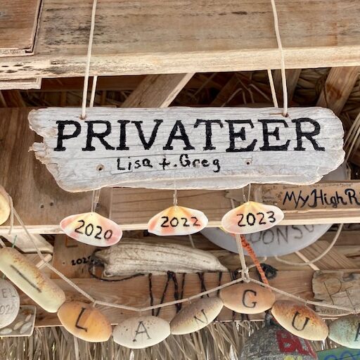
PRIVATEER is in the background, so far away that she is not easily seen. Before the road was built, the only way to move up and down the island was by boat and these jetties were important. Now there are no boats and no reason to maintain the jetties. Leaving Pompey Bay we were getting hungry and thirsty so hoping Delectable Bay had more activity.
The store in Delectable Bay
When the population of the settlement is only about 20, there is no need for a sign to identify the local store. We would have missed it but for the lady near by that invited us in. Not much to sell, some dry goods, a few sheets of drywall and, thankfully, some cold Kalik!
Our next destination was Ragged Island and the distance required us to reposition near the west end of the Bight in order to cross over to Ragged and arrive before dark. We anchored at the tip of Long Cay in order to hop out to sea around 2am.
After our anchoring experience at Delectable Bay I was hoping for a little better set this time. While the set wasn’t perfect, a bit of a sea grass ball rolled up under the anchor, a calm night was predicted so all was well.
The weather pretty much dictated our early departure. A significant cold front was heading our way and there is no west protection in the Bight. We did miss out on some land adventures that we had planned, but as a cruising ground, its hard to get too excited about the Bight of Acklins. We hear that there is some good snorkeling further south and we didn’t get down there, but the route is a bit shallow for our 5′ draft. It is also difficult to get near shore for any wind protection as the slope of the shore is shallow quite a ways out into the bay. And did I mention the holding is difficult?
We installed flopper stoppers as part of the build and commissioning process three years ago. And never used them until just last week. Not that we haven’t rolled, we have. But were heretofore either too lazy or too late to deploy them. More on the “too late” comment later.
For those of you unfamiliar with the various stabilization options for a trawler such as ours, there are two approaches to enhanced stabilization while running, paravanes or hydraulic fins. We have hydraulic fins for stabilization while underway. They work well, as long as the hydraulic systems are operational. Paravanes also work well, but do not require hydraulics, so you might see a serious ocean crossing trawler with both for redundancy.
Paravanes and flopper stoppers look somewhat similar, so might be confused with each other. But paravanes drag a “fish” though the water that dives with speed and this creates very strong loads on the system. Paravane systems are therefore pretty beefy. You see them on commercial fishing boats everywhere.
Flopper stoppers just pull drag panels up and down while the boat is at anchor and therefore are not nearly so strong. Looking at the picture above, you can see how the system functions. Poles are deployed from either side of the superstructure, guyed from the mast above and then with lines fore and aft. The drag panels, we call them doors, are then lowered from the boat deck into the water. They function by sinking easily but providing resistance when pulled up; the “doors” open and close in opposition to each other with the roll of the boat.
The Doors
Here is one of the doors. You can see it is hinged down the centerline, with cables for connection to the down line. They are about 3’x3′ and weigh about 20lbs. They can be a bit awkward to raise and lower. They can easily bang against the hull if you either are not careful, or you are already rolling. And this is what I meant about being “too late” to deploy the system.
lines from top of the mast
These guy lines hold the pole out perpendicular to the boat and horizontal with the water.
Pole attaches to the side of the boat at the upper boat deck
The poles tuck up against the boat deck when folded back and then pivot out when deployed. The operation can be a little tricky. The attachment point also needs to be well reinforced. We specified the system at time of build so this area was beefed up in the mold. This can be accomplished as an aftermarket operation but requires a bit of work, with maybe some advice and councel from the builder. I know some folks have mounted their poles lower on the hull in order to make it easier to reinforce.
Note that we have a mast. We had originally specified an arch but the builder determined that the arch did not have sufficient height to enable the angles necessary to support the poles. Now that we have the mast, we sorta like the look! As an aftermarket install to a boat with an arch, a center pole for support might work well.
Our poles are carbon fiber to keep them light, but aluminum works well. They look like re-purposed spinnaker poles and that is probably what they are (were).
Deployment takes about 15 minutes if you keep all the lines attached. We are looking at adding additional lines to aide in dropping the doors over the side and may have storage bags fabricated that attach to the outside of the boat deck rails to simplify deployment and retrieval.
So, how does the system work? We are quite pleased with our first experience. We were anchored in a bay with direct wind protection but were expecting a wrap around swell with an oncoming front. When the swell arrived we did roll, but the roll max angle was lower than expected, the roll rate was much slower and the roll attenuated much faster than in the past. After an initial roll, the next roll was about 50% of the first, and so on.
This was a mild swell, visible to the eye but less than a foot in height. Plenty to roll us when abeam the swell. We were able to sleep through the night just fine.
We do have a concern about what we would do if we needed to vacate an anchorage in an emergency. Lots of gear in the water. Although we haven’t tried it, we believe we could motor short distances at low speed, to re-anchor for example, with the doors just raised out of the water. For more estensive maneuvering we could pull the doors up on deck but leave the poles extended. Not a perfect solution, but it could be done quickly.
We are headed to Cambridge Cay next and will be there for a month. With a strong North wind a pretty good swell can come in so we will deploy the system for the entire month and report back on performance.
We came over from the Bahamas in Late November. The plan was to spend Christmas at Blue Haven Marina, hosting our sons and their significant others. Thought I would provide a few notes on our initial impressions.
We did the trip as an overnight from Georgetown and got here mid day. Our first port of call was Turtle Cove Marina on the north coast of Providenciales. Two marina options here, Turtle Cove and Blue Haven. Both are accessed through a cut in the reef. Sellers Cut, leading to Turtle cove is winding and at times narrow and shallow. My best estimate is maybe 6.6′ at low in one spot. We used the free escort in and out. We arrived with about 18 knots wind and maybe 6′ rollers at the entrance. looked a lot more challenging than it turned out to be.
Turtle Cove is a decent marina. I wont comment further, as the Active Captain comments are, in the aggregate, accurate. I would go there again. Our objective going here was to save money till we needed to be at Blue Haven as it is half the price.
We left Turtle Cove and went out the cut and up to Blue Haven. The cut into Blue Haven is straight and deep. Maybe 7’+ at low. No need for an escort. Blue Haven Marina is associated with the resort next door and all the amenities are provided to marina patrons, which is why we came here. Actuall three resorts, connected with shuttle services. The other two resorts are on Grace Bay, which is beautiful.
The resort itself is, at best, in transition. Never rebuilt after a hurricane two years ago. Some of the wrecked power sub stations are still lying around on the dock, just where they ended up after the storm, I presume. One dock is connected to land and has power and water. The other dock is free floating out in the channel. No power or water and a dinghy ride in. Still, a few mega yachts out there, as it is the only place they fit.
The dock we are on is mostly sport fish and chartered mini mega yachts. Also a few day boats for the tourist crowd. Lots of activity and not too much hassle. Maybe a bit more techno-Reggae than I would choose.
Decent kayaking in the mangroves and spectacular snorkeling out on the reef when it is calm, which is rare this time of year
DCIM\101GOPRO\G0382709.JPG
Took about 200 shots before I got this one of a Green Turtle. Mangroves are full of these guys but they only come out to feed at near high tide.
There are two other marinas on the island, both on the banks side. South Side is small but well maintained and has a nice bar and restaurant. Otherwise a bit secluded. Shallow entry. Maybe 6′ at high? We wee there by car.
Caicos shipyard carries a bit more water coming in. Also rather secluded. Docks being upgraded. New buildings. Promising. Also the only plae with any maintenance capability.
Provo has many fancy high rise resorts and lots of villas along the beach. good restaurants. Great grocery store, etc. Good roads, plenty of traffic, etc. Lots of expats mixed in with the locals. Somewhat different than the Bahamas. rental cars relatively cheap, taxis quite expensive. We use our bikes for shopping.
Cruising the TCI is somewhat challenging in mid winter. The typical northern swell will make many of the anchorages somewhat uncomfortable. We have tried to head over to Grand Turk, but the only anchorage is a roadstead and dinghys go to the beach. A challenge when there is any surf.
We are in Stuart, FL and will move down to Lake Worth tomorrow to stage for crossing the Gulf Stream on Friday, headed to the Bahamas. This will be crossing number ten or so, but I really do not feel I have a tactic to make the best of the Stream’s current.
(edit: I first released this on 9 Nov. just after the crossing. Then realized maybe doing math after no sleep is not a good idea. So if you read this yesterday and had some issues with the math, I apologize. Hopefully my edits have corrected the math errors)
On the sailboat we were usually between New England and the Caribbean and the Stream was just a small distraction on a 1500 mile trip. Our tactic was to cross at right angles to the current and just maintain our general heading. The current would set us twenty miles or so, one way or the other. By the time we exited, we would just adjust our heading by a degree or two and keep on sailing. The word was, do not crab into the stream.
But sitting here in Florida, and wanting to go to Bimini, for example, the problem is a little different. I don’t really want to get set twenty miles north on a sixty mile trip. And I don’t want to run all the way down to the Keys, just to get a better angle. So I have been wondering just what is the most efficient method of crossing the Stream.
In central and southern Florida the Stream is about forty miles wide and has current from 2-4 knots, averaging 2.5 knots for the forty miles. A little internet searching will bring up as many tactics as there are sailors, but one can winnow those tactics down to just a few.
The first approach is to go south on the Florida coast in order to improve the angle, say Angelfish Creek to Bimini. This approach does provide a relatively quick, day hop, and if your goal is shortest possible time on the passage, this works. But proponents of this approach tend to forget about the days spent moving down the Florida coast, not to mention the pain of all the bridges if you do the trip inside on the ICW.
For the other approaches, lets use a trip from Lake Worth inlet to West End, Bahamas. About fifty-five miles on a bearing of 95 degrees. The Explorer Charts recommend the classic navigation technique of calculating the required offset for the current and then setting a heading to accommodate that offset. See below.
Assuming one holds a constant heading, this tactic will generate a ground track roughly “S” shaped as the current first increases then decreases during the trip. Not sure why they say, “Dont angle into the current” because that is just what you are doing here.
This approach has lead to some folks suggesting sailing a purposefull “S” track. Proponents of this tactic suggest leaving Lake Worth and turning SE even further than necessary to hold the rhumb line. Getting ahead of the current, so to speak.
Waterway Guide provides headings for various boat speeds and destinations, essentially the same as the Explorer chart Again, holding a constant heading to counteract the average current will produce an “s” curve track.
Then there is what the old salts told me way back in my sailing days. And that was to take up a heading perpendicular to the stream and let the stream set you. Then angle back to your destination once clear. This does have the advantage of getting you out of the stream the fastest, even if it does drop you off fifteen miles north of your desired track.
Finally, there is the approach of letting the autopilot carry you across the stream exactly on the rhumb line. This approach will get you across the stream in the shortest distance, as compared to the previous, shortest time approach.
As an aside, think about what would happen if boat speed were four knots and if the Stream were four knots. If you let the autopilot drive, you will stand still, with speed through the water of four knots and speed made good of ZERO! On the other hand, if you took the perpendicular heading approach, you would still get across the stream, albeit far from your intended destination.
So what is the modern mariner to do! Time for a little math. Using a speed through the water of 8 knots and a current of 2.5 knots for a distance of 40 miles, I would estimate about 12 miles of drift north. That would require an 11 degree offset and reduce my velocity made good (VMG) by one knot. That would increase my time by 45 minutes or so.
Alternatively, I could cross at 8 knots by not crabbing, then come back south 12 miles, which would increase my time by 1.5 hrs.
In the final analysis, all of the options fall in between those two options; the “S” curve approach is a compromise between the shortest time and shortest distance approach.
I plotted a course across the Gulf Stream and estimated the speed of the current every 5 miles. Here is my slice across the Stream, crossing from Lake Worth to West End
And then I built a table of headings and speeds for each 5 mile segment of the trip.
NM
0
5
10
15
20
25
30
35
40
Leg
0
5
5
5
5
5
5
5
5
Knots
1
2
2.5
3
2
2
2
1.5
1
Course
95
95
95
95
95
95
95
95
95
STW
8
8
8
8
8
8
8
8
8
HDG
102
109
113
117
109
109
109
106
102
Corr.
7
14
18
22
14
14
14
11
7
SOG
7.7
7.5
7
7
7.5
7.5
7.5
7.5
7.7
Hrs1
0
0.6
0.6
0.6
0.6
0.6
0.6
0.6
0.6
Hrs2
0
0.7
0.7
0.7
0.7
0.7
0.7
0.7
0.6
Set (NM)
0
1.3
1.6
1.9
1.3
1.3
1.3
0.9
0.6
If this is accurate, it should take me 5 hours, 45 minutes to cross, versus the 5 hrs with no current. Frankly, I doubt we will do this well.
My plan is to capture our actual headings and ground speeds every 5 miles and compare them to the calculated values.
My hypothesis is that the fastest way to get from point A to point B, in the presence of current is the shortest distance route, not the shortest time route. And that means running the rhumb line. The easiest way to run the rhumb line is to let the autopilot drive the boat, so that is what I will do.
Note that our ultimate destination is Palm Cay on New Providence. So the full question gets a bit more complex. The route we will take, crossing the stream at right angles, results in a total distance to our destination of 201 nm. If we were to go by the most direct route, the course would cross the stream on a course of about 125 degrees, angling into the stream. So the bigger question becomes: is it better to cross at right angles to the stream, even if that takes you out of your way. In this case, 10 miles out of your way.
I will update the blog after our crossing. We will do the 40 mile test run, then turn south and run overnight to Palm Cay marina, so give me a few days to do the data analysis.
Part 2 Trip complete:
Good news is, the trip was great. Stream was smooth and for the rest of the trip the water was like glass. And a 3/4 moon to boot. So how did all the calculations work out? Below is a table that shows the calculated GS current and the actual current derived mathematically from my actual headings and SOG. (speed over ground). (Best I can do to get all the numbers on the chart)
Miles
0.0
5.0
10.0
15.0
20.0
25.0
30.0
35.0
40.0
Leg
0.0
5.0
5.0
5.0
5.0
5.0
5.0
5.0
5.0
Estimated current
1.0
2.0
2.5
3.0
2.0
2.0
2.0
1.5
1.0
Course
95.0
95.0
95.0
95.0
95.0
95.0
95.0
95.0
95.0
Speed Through Water
8.0
8.0
8.0
8.0
8.0
8.0
8.0
8.0
8.0
Estimated Heading
102.0
109.0
113.0
117.0
109.0
109.0
109.0
106.0
102.0
Estimated Speed Over Ground
7.7
7.5
7.0
7.0
7.5
7.5
7.5
7.5
7.7
Set
0.0
1.3
1.6
1.9
1.3
1.3
1.3
0.9
0.6
Actual Heading
110.0
116.0
115.0
116.0
109.0
103.0
102.0
101.0
100.0
Actual Speed Over Ground
7.7
7.5
7.5
7.5
7.7
7.8
7.8
7.9
7.9
Actual Current
2.0
2.7
2.6
2.7
2.0
1.5
1.0
1.0
1.0
As you can see, the actual current in the Stream was a bit less than calculated, so our speeds were better than planned. With a no-current crossing time of 5 hours, and an estimated crossing time of 5hours, 45 minutes with the calculated current, our crossing time was 5 hours, 25 minutes. Our total time for the 201 mile trip was 25.5 hours, exactly as predicted, which means we were slower than 8 knots for the portion of the trip once we exited the stream.
Now lets compare this to the direct route. The no-current total time for the 191 miles at 8 knots would be 23.9 hours. At a 125 degree heading across the stream we would be in the Stream for 50 miles at an average speed of 6 knots. At that speed and distance it would take us 8.33 hours to cross the stream. We would complete the remaining 141 miles at 8 knots in 17.6 hrs for a total time of 26 hrs, all that using the original calculated estimate of Gulf Stream current.
However!! The stream was not as strong as estimated. If we use the actual stream data calculated from our actual trip, then the direct route crossing would not have taken 8.33 hours but just 7.8 hours. And that would result in a total trip time of 25.5 hours. Exactly the same!
A brief note on geometry here. As angle A, in this case the angle between a route perpendicular to the current and one angling into the current, increases, the hypotenuse, in this case, the time/distance in the Stream, increases rapidly (geometrically, actually). So in our case, with a direct route angle of 122 degrees and the estimated current of 2.5 knots, it is better to take the perpendicular/shortest distance route. At the actual current of about 2.2 knots, the two trips are identical in time. At this angle, slower current favors the direct route and stronger current favors the perpendicular route. With lesser currents a larger angle of attack can be taken. With stronger current, say the more typical 3 knots, then the perpendicular route will be favored.
And a last note about boat speed. The slower the boat, the more favored the perpendicular route will be – up to a point. If your boat only goes 4 knots, and the current is 4 knots, take a plane. Just kidding, but in this whole experiment we used a constant 8 knots and variable angles of attack and current level. Varying boat speed leads to the same conclusion, the more time you spend in the stream, the larger the penalty.
With all this, my conclusion is: the fastest way to cross the Gulf Stream at typical current levels is to cross at right angles and crab into the current sufficiently to maintain a course perpendicular to the current. And the best way to accomplish that is to use a capable autopilot.
I understand the “S” curve idea, but I believe it is a hold over from when autopilots just held a course. Using old fashioned navigation skills to calculate a heading to counteract set and drift, a constant heading would result in an “S” curve track with the Gulf Stream current. But that does not make an “S” course efficient.
Of course this over-simplifies the problem. If you are trying to make a day hop of it, and want to check in at Bimini or West End, then you might need to pick and choose your departure point. Lake Worth works well for West End, Fort Lauderdale or Miami for Bimini. And the slower your boat the more you might need a lift from the stream to improve your ground speed. And finally, if the weather stinks in the stream, moving south in the meantime might improve things. But I wouldn’t waste time going to Miami for the angle if the weather was decent when I was still in Lake Worth.
Finally, a note on calculating speeds, angles and distances. The easiest and quickest way is with an old fashioned E6B flight computer, nowadays available on a computer or as a phone app. Using the tool you can quickly and easily test various alternatives and choose the best combination of launch point, course, etc. So, try this experiment yourself and see what you find.
The 12M Worlds were here this summer. One day they raced in Narraganset Bay so we took the boat up to watch. We hung around for the start then positioned about half way up the course and watched the early starters on their spinnaker runs while the later starts tacked upwind. A spectacular sight. Some folks wish the Americas Cup would go back to these more “traditional” boats. But back then, they were cutting edge, just like the mono-hull planing boats being tested now for the next cup.
Saturday morning the 12M fleet did a parade of boats through the harbor. We took the dinghy over and watched. Days like this are why we spend our summers in Newport. What follows is just a photo collection of a few boats from the parade. Hope you enjoy.
APHRODITE was built by the Purdy Boat Company and launched in May of 1937 for Wall Street financier and later Ambassador to the Court of St. James, John Hay (Jock) Whitney of Manhasset, Long Island. APHRODITE’S guest list over the years reads like a “Who’s Who” in the worlds of government, business and entertainment with such luminaries as Fred Astaire, Sir Laurence Olivier, Spencer Tracy, Katherine Hepburn, Henry Ford II, FDR advisor Harry Hopkins and Nelson Rockefeller aboard for summer day cruises down Long Island Sound. APHRODITE also once served as the site for a birthday party for Shirley Temple. She can do 30 mph.
We took Privateer out today just to check all the systems after a 2000 hour service and a change of all her oils and fluids. All that went fine.
The area just north of Newport can be pretty crowded so occasionally someone shows up near us that I didnt see coming. In the picture below you can see Big Blue on AIS coming by. She is a 45′ cabin cruiser doing 25 knots.
Big Blue comes by on our port
So I look out the side and see nothing. I get up and go to the door, nothing. Then a minute later she disappears from the screen as well. I search the screen and she reappears about a mile north, where she really is.
My assumption is, there was a malfunction in either her transmission or my reception. More likely her transmission. I have seen AIS return for boats showing them going backwards or sideways, a transmission error that I could sort of comprehend, but this is the first time I have ever seen a boat displaced by more than a mile. The ramifications are quite disturbing.


You must be logged in to post a comment.