Cambridge Cay – Exuma Land and Sea Park

Kayak on the stern of Privateer

We spent the month of February as volunteer mooring field hosts for the Exuma Land and Sea Park. Our primary duties were to collect mooring fees, explain the park rules and provide information on snorkelling and hiking in the park. We also cleared trails and picked up trash. And despite all the work we managed to do a fair amount of hiking and snorkelling ourselves. All in all, a very nice way to spend a month in the park.

Collecting mooring fees

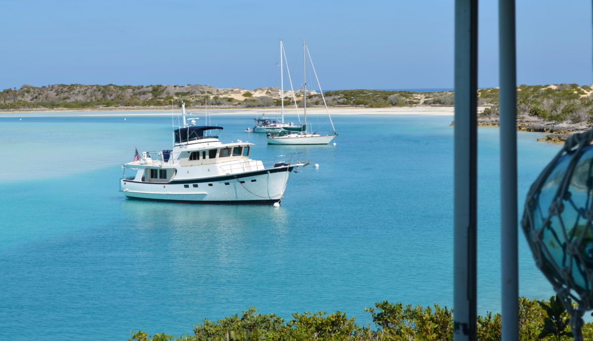
Every day we travel throughout the mooring field to collect fees. Usually a mid-day trip and then one more before happy hour. takes about an hour a day. The field has nine balls for cruisers and three for mega yachts.

A couple of big boys

The mega yachts in the park are sort of a mixed blessing. They bring much needed revenue, paying $100-150 per night, but sometimes bring more noise and activity than some folks would like. For the most part, they behaved themselves, but we probably don’t need the jet skis.

Trail maintenance in paradise

The land is rather arid but the vegetation still manages to overgrow the trails so we spent a few days hacking back the sides of the trails and adding markers to make them easier to find.

Happy hour on the sand bar at Cambridge Cay

We are also often the social directors for the anchorage. All that means is that we announce a happy hour on the beach. Easy to get a crowd.

Pleiades

We maintain a 24 hour radio watch, just in case some emergency arises in the field. Mostly pretty quiet for the month but these folks had a problem with their batteries and could not start their engine. No TowBoat US down here. Or anything remotely resembling a boatyard. Luckily we carry a set of battery cables and we were able to jump start his engine with a spare battery he was carrying.

We also rescued a “dinghy in distress” trying to row back from Rocky Dundas. Took us 20 minutes just to tow them back so no telling how long it would have taken them to row against the current.

Fish Finder

We are part of a study of fish migration sponsored by the Smithsonian. Whenever we anchor we put a sensor overboard that responds to RFIDs on tagged fish. We wont find out what fish we have tracked until the finder is returned next spring.

Green Turtle

We spent lots of time in the water “harassing” the green turtles. After a while they just ignored us and if I was in the water I could get pretty close for a photo.

Blue Hole Beach

This is one of our favorite beaches on the island. Not really a blue hole as it is only 30 ft deep or so, but the colors are special. Kayaks were a perfect means of transportation because the area dries at low.

kayaks at Blue Hole Beach, Cambridge Cay
Bell Rock at Cambridge Cay

One stunning view after another. Just when you think you have seen everything in the area you get a view like this.

Spotted eagle ray

Spotted eagle rays came by most every day. Occasionally they would leap entirely out of the water. Pretty impressive for a beast with an 8′ wingspan.

Sting Ray
Sting ray up close and personal

Sting rays are everywhere and rely on their coloration to hide in the shallows. We were careful to shuffle our feet when wading. In the kayaks it was possible to go right on top of them before they would spook. This one reminds me of the F117 stealth fighter.

Sea Aquarium

One of our favorite snorkelling sites is called the sea aquarium. Just a small indentation in the rocks but after years of folks feeding them, the fish are quite friendly. If you don’t feed them they finally get bored with you.

Sea Aquarium dinghy tie up

Lisa with her friends

The fish will get close enough that you can even touch them.

Porcupine Fish

This guy was a little less friendly.

Conch

Queen conch is endangered throughout the Bahamas due to over-harvesting, some of it legal and some not. The park is a no-take zone and has become a critical part of protection and regeneration of all sorts of marine life. These conch would be easy picking outside the park and the fact that they are even here at all suggests that the park’s efforts to protect the wildlife is working.

In our snorkeling we have seen spiny lobster, Nassau grouper, and many other species of over-harvested wildlife that are rarely seen outside the park but are doing well inside the boundaries of the park. There are a number of marine protection zones in the Bahamas besides Exuma park but Exuma park is the only one with the resources to combat poaching. Hopefully more will be done in the future.

Park patrol boat

While we are at Cambridge there is little opportunity to replenish stores. Once a week or so someone from the park staff comes by and takes Lisa in to Staniel Cay for a little grocery shopping.

Nurse Shark

Nurse sharks are constant visitors to the anchorage. They are pretty harmless. Caribbean Reef sharks come by as well and are less docile. They pretty much ignore swimmers, as long as they aren’t being fed. Unfortunately some visitors to the park dont understand this and we have had to admonish a few folk.

Most visitors cant distinguish from one shark species to another and feeding nurse sharks is a popular tourist draw at some of the local marinas. So visitors come to Cambridge and feed the sharks that come under their boat. But they are feeding Reef sharks while other boats have kids swimming near by. We have also seen Hammerhead sharks in the park and others have seen tiger sharks. Lets hope nothing happens.

Obrien’s Cay

The colors of sand and sea and sky in the park are just incredible. Every time we think we have found the ultimate beach, we find one more. This is on the northern tip of Obrien’s Cay, just around the corner from the sea aquarium

Hog Cay

This is not from Cambridge, but from Hog Cay, another park mooring field. We spent a week there, hiding from a significant cold front. We were the only boat there for the entire week. Lots of current, but excellent mooring ball.

Mooring gear

When we visited the park last year the moorings were in a state of disrepair. Joe and Nicola Ierna had just taken over as park administrators and were focusing on replacing all the gear. None too soon as we saw at least two boats break their moorings in the month we were there. For our month of volunteer work that year I dove and installed my own line to the anchor post on the bottom.

The new mooring gear is beefy, to say the least. Mega yachts lay on the same size gear as the cruiser boats so we can feel pretty safe. The down line is now all chain and the pendant is 1.5″ nylon. Also, the ball itself is not part of the system, a significant improvement over the old design.

Cambridge sunset

Speaks for itself. Another day well spent at Cambridge. We were sad to leave but will likely return next year.

This was our second year to volunteer at Cambridge and it was equally rewarding. We met hundreds of cruisers passing through, collected neary $10,000 in mooring and anchoring fees, and did a bit to clean up our little part of the park. And managed to have some fun doing it.

Having visited the park a number of times over the last few years, we are excited about the revitalized efforts to improve the park now that Joe and Nicola, along with Brent the warden, are on board. The new moorings, the increased policing, the upgrade of the facilities, all are much needed and much appreciated. We are blessed to have them running the park and equally blessed to call them friends.

Exuma Cays Land and Sea Park – Short Note

DCIM\100GOPRO\GOPR0335.JPG

Hello,

We sat out a significant front here in Hog Cay on a park mooring. Nice new beefy gear so we felt nice and secure despite the winds gusting into the low 40’s from just about every direction. Strong currents make for exciting times when the wind and the current oppose. As in past visits, January is a very active month for cold fronts and affords short periods of cruising between longer periods of hiding from adverse winds.

DCIM\100GOPRO\GOPR0366.JPG

In between fronts we have been enjoying ourselves. Snorkeling at Obriens Cay is always a favorite. The dive site is called The Aquarium and is in the park. People feed the fish here so you get swarmed as soon as you enter the water. Learning how to use my new GoPro camera so my underwater shots need work.

DCIM\100GOPRO\GOPR0489.JPG

We are now at Cambridge Cay doing our stint as mooring field hosts for the park.We will be here a month. We give out maps, collect fees, maintain the trails and other duties in return for a free mooring ball in a little piece of paradise. The water in the Bahamas is very easy on boat bottoms. We had her cleaned in Key West in December and still no growth.

We are also participating in a fish research project for the Smithsonian. Whenever we anchor we drop a listening device into the water and it picks up signals from tagged fish. Unfortunately we will not know which fish we “saw” until we return the device in the spring.

DCIM\100GOPRO\GOPR0396.JPG

One interesting adventure is a cave system called Rocky Dundas. At low water you can swim inside to see a spectacular grotto. Best on calm days. This is Lisa swimming out behind a friends from Mystic Star.

DCIM\100GOPRO\GOPR0414.JPG

friendly Barracuda keeps an eye on us. Harmless but they open and close their mouth to breathe, showing some impressive teeth. The also like to follow along behind divers, just out of sight.

Crossing the Gulf Stream to Great Harbour Cay

Kalik in paradise

Nothing like a cold beer after a Gulf Stream crossing. As crossings go, this one was just fine, if a bit bumpy at first. A different sort of crossing in that we were coming NE from Key West so crossing the stream at about a 30 degree angle. We left Key West at about 8am, figuring on covering the 225 NM at a fast average speed over the ground of 8.6 knots, 1.1 knots above our actual speed through the water, thanks to the boost from the current in the stream.

We originally planned to enter the banks at South Rock with an option to choose a more northerly course to enter the banks above Bimini if we didn’t like the conditions. This would add about 12 miles to the trip but would also give us a bigger boost from the stream.

In my planning I estimated the GS current at 3.5 knots and with our angle of attack figured about a 15 degree offset angle to hold course and a 2 knot resultant boost in speed. As it turned out it was taking closer to a 25 degree offset to hold course and we were not getting quite 2 knots of boost. At a boat speed of 7.5 knots and a steam speed of 3.5 knots it doesn’t require much of a miscalculation to throw off prior estimates. In this case, I figure the angle of attack was closer to 45 degrees so the required crab was much greater. Had I seen that coming I might have entered the stream a bit further south. Maybe next time. Hard to calculate the best approach between taking the shortest route and getting the best speed boost.

With lots of unknowns regarding what was going to happen later that night with winds and sea state we decided to turn north to improve the ride, reduce the crab angle and maybe pick up enough extra speed to absorb the extra 12 miles of total distance. Also, the wind was forecast to clock further to the west in the early morning hours which would put it more astern after our turn east at North Bimini. As it turned out, the wind never clocked and stayed at about 225 degrees throughout the night and morning, but still behind the beem, so just fine.

We can see out 64 miles with our radar so I began tracking and timing the advance of the front i knew was coming some time Saturday morning. At 3am it was moving at about 12 knots so would arrive right on time at noon. With that estimate we planned on standing off until the front passed, possibly testing our new lightning protection system. By 10 am, when we were 2 hours out, the front had slowed to 8 knots and would not arrive until 1pm. Plenty of time for us to get in and tied up before it it. As it turned out, the first slip designated for us didn’t agree with our boarding doors so, with the lightning and thunder near, we moved to a more agreeable slip. We had the last line secured when the front passed over. Lucky timing on our part.

We will stay here a week, with plans for kayaking, bicycle touring, and maybe some fishing and conch hunting. And maybe a few more Kaliks on the beach. Then we will begin moving towards the Exumas. The Exuma Land and Sea Park is expecting us on 1 February for our one month stint as mooring field hosts at Cambridge Cay. After that, no real plans.

Canaveral to Key West

“Mile Marker” Zero?

We made it to Key West, a milestone of sorts. We are here for a month or so and will celebrate Christmas with our two sons. Then it is off to the Bahamas.

The leg from Canaveral to Key West was relaxed as we had time to kill before our slip reservation at Boca Chica Marina near Key West. Our first night out promised to be lumpy with strong winds out of the North so we chose Suntex Marina (formerly Loggerhead) in Vero Beach. We had never been there and were somewhat concerned about the channel as there were numerous Active Captain comments about hard obstructions in or near the channel. All I can say is that we had no issues and I would estimate at least 6′ at low tide. Once inside, the marina was very nice and totally protected.

We followed up with some locals regarding the channel and one fellow provided us a set of soundings that he had taken with his dinghy. Those soundings did show some shoal area encroaching on a portion of the channel, not quite reaching the centerline. I am sure those write-ups in AC were true, in that the boats hit something, but maybe not so accurate in that whetever they hit, it was not on centerline. We left the next morning following our breadrumbs from the day before without any problems.

The charts show just a few pilings but there are actually 8-10 on each side of the channel so it isnt that hard to stay centered. If anyone wants a copy of the soundings for the channel, send me an email.

A note on Active Captain. I read the reviews and check the hazzard comments on my route, but often the hazzards just arent there. All I can figure is that the authors just werent where they thought they were when they encountered the problem. As best I can tell, nobody reviews the data and once a hazard is logged, it stays on the charts forever, despite numerous comments that the hazard just isnt there. More on this later.

Our next stop was Peck Lake. This is another interesting spot becasue the charts show the area to be 3-5′ deep when there is a large area 10′ or greater. But the only way to figure out just how large the area is requires probing with your hull. Not my favorite. In this case, the AC comments are helpful as they describe where the “gate” is as you leave the ICW and enter the anchorage.

For us it was fairly easy because there were just a few boats there. We picked a spot with plenty of swing room and felt a good set on the anchor. By the way, you know how a dog circles his spot before lying down? I understand that is to insure he doesnt cover a gopher hole or whatever. Well the same sort of move works with a boat. If we arent sure we will have minimum depth throughout our predicted swing we will circle our spot to confirm, doggy style.

It looked like a fine evening, until the bugs arrived. And did they ever. By morning we were covered in bugs that looked sort of like mosquitoes but didn’t bite. They just left stains everywhere. And they stayed with us for days. What a mess.

Lake Worth inlet and anchoring options

Our next stop was Lake Worth to an anchorage just south of the inlet. There are three options for anchoring here. Just south of the inlet, at the northern most AC symbol, you can anchor just south of the channel. It is close if you want to enter or leave in the dark. But the current is strong and it is quite deep at 20′ or so. The next spot, just south of the large spoil area, is close to the inlet but somewhat crowded with a mix of moored and anchored boats. Further south, roughly east of Rybovich Marina, is 1.7 miles from the inlet but wide open. We chose this spot and had a pleasant night.

We left the next morning just before sunrise. There is added light from land so not so hard to leave in the dark and run along the docks to the inlet. Lucky for us, the weather was perfect for an outside run to Miami, skipping the most concentrated series of bridges along the Florida coast.

Venetian Islands Anchorage

We have anchored here a few times. Well protected but can be busy with tour boats, jet skis and the like. Better on weekdays. There are a couple of No Anchor spots as well. Under current Florida anchoring laws there are very few places you cannot anchor. These are some of them. The houses here are all million dollar plus and the rumor is, a few have enough political pull to prevent boats from disturbing their views. Whatever, still plenty of places to anchor that are out of the way of traffic and protected. Last year we anchored between San Marino and Di Lido, this year just SE of Palm. A good place to wait on a hop east to the Bahamas or, in our case, south to the Keys.

Our plan was to stay inside Biscayne Bay to Anglefish Creek, then go out to Hawk Channel for the rest of the trip to Key West.

Anglefish Creek

Anglefish Creek is one of the last places a boat drawing 5′ or more can exit to Hawk Channel. The ICW continues but there are large portions where the depth is less than 5′, especially at anything but high tide. But reading the AC comments about the creek suggests there are areas of less than 5′ in the channel as well as hidden obstructions. Here is another example where blind allegiance to AC comments will keep you from going places that are safe.

Since we had a few days to kill, waiting on weather, I took the dinghy out and sounded the entire creek. I also talked with numerous boats passing through the creek in both directions. From my readings the lowest points are at the entrance and exit from the creek. On the Biscayne Bay side, the lowest point is 7′ MLLW and on the Hawk channel side, 6’3′. And I could not find any obstruction between marks 1 and 3 as AC described. I did chat with the author of the AC obstruction comment and I am sure he really did hit something at that point, but my guess is, it was some sort of partially sunk log that had since drifted off.

Our first time in Hawk Channel. My two comments; the barrier reef does cut the swell from the east, but doesn’t really help with the wind driven wave. And the number of crab floats will keep you paying close attention to your path through the mine field.

There are not a lot of anchorages with much protection from anything above 15 knots from the east so a run down Hawk channel requires a bit of weather planning. There are only a few bridges that will allow a cross over to the other side of the Keys in order to get out of wind or wave. We anchored one night on the far side of Channel Five Bridge and then went to a marina in Marathon to avoid a cold front.

WE spent a few days at Marathon Marina and Resort, just inside the channel into Boot Key Harbor. A very nice marina that is cruiser friendly and has decent rates for extended stays. Marathon served our purposes well but we had a hard time appreciating the attraction to the mooring field in Boot Key Harbor. Hundreds of boats here, many for the season. Nice weather, good protection and cheap rates, but not particularly attractive. And it is hard to fall in love with the town of Marathon itself.

We did enjoy a tour of the Turtle Hospital in Marathon, which is a real working turtle rehabilitation facility. Tours are a little pricey at $25 or so, but since the proceeds are important to funding their work, then maybe not so bad. We also checked out the bars in the area and give two thumbs up to the french fries at Burdine’s.

We next headed to Boca Chica and our marina for a month. Boca Chica is home to Key West Naval station airfield and an MWR marina. The marina was a mess after the last hurricane, with many boats sunk in their slips, but now it is up and running and nearly full. Not all repairs are complete but it is in pretty good shape. Tiki bar, small restaurant, beach, etc. And $1/ft. But only for military.

We are about seven miles from old town Key West, so having a car is helpful. We have been doing the tourist things in town, and it is a touristy town, but it is also a town with plenty of legitimate history if you look past the Tee shirt shops on Duval street. Maybe a dedicated blog post on Key West in the future.

The boys are both here for Christmas so their christmas present was a day of deep sea fishing. Fishing is a big deal here, with hundreds of charter boats available so choosing one boat was a challenge. We did a lot of internet searching but finally settled on a boat we had seen arriving at the dock by our happy hour bar. Among the six boats at the dock, this boat had the most fish. We chatted up the captain and liked him and hired he and his deck hand for the day before christmas. The boat name was Triple Time and I would recommend it. An older boat but a great crew. And of the returning boats, we had the biggest catch.

The catch

We caught all five tuna in about an hour. None before or after. Other boats that missed the window got nothing. Our captain said he had been doing this for 40 years so I am guessing our success was not just luck. The biggest tune weighed in at 25 lbs. We are still eating it.

We would have had one more tuna but a shark beat us to it.

Grayson with what is left of his tuna

The Trip South, from Norfolk to Port Canaveral

We have had enough weather surprises, mostly disappointments on this trip south, when actual conditions were worse than forecast. Nice to get a pleasant surprise now and then as we did for the trip from Savannah to Cape Canaveral. Overnight we had 10 knots from behind, a 2′ swell and 90% illumination all night. It just does not get any better than that.

   Lets back up a bit. Our near term destination for this leg was to get to Key West in time to host our two sons for Christmas. We had five weeks, more than enough time to take it easy and maybe add a few side trips. our plan was to travel offshore whenever weather permitted, limiting it to one overnight at a time. Once we arrived in Florida we no longer had to worry too much about weather as we could always run inside, but we really wanted to avoid the leg between Lake Worth and Miami as the number of bridges can really get to be a pain in the neck.

From Mobjack we we next stopped at Atlantic Yacht Basin. Decent fuel prices, no current, friendly folk. Our favorite activity here is to tour the covered docks. Some beautiful older boats, including a spectacular Trumpy, in pristine condition.

Coinjock may become a tradition. A short run from AYB so we arrived early, which is good here, and enjoyed our prime rib. Coinjock dock hands are famous for stacking boats tightly here, often with overhang fore and aft, so getting here early makes arrival and tie up easier. Best you not be watching as they bring boats in behind you. And also best if you let some of the boats depart first.

From Coinjock we took the “road (somewhat) less traveled” down Pamlico Sound, stopping in Manteo and Ocracoke. Overall, this route is shorter than the ICW, less crowded and with fewer hazzards. The only drawback is that Pamlico Sound can get rather nasty in any significant winds. A 20 knot wind can set up a rather nasty 3 foot, 3 second wave pattern than is uncomfortable even for us. Our route is in blue, the ICW in green.

The Pamlico Sound route

Manteo has a nice small marina, some anchoring opportunities and plenty of land adventure opportunities. The entrance channel is a little tricky, but holds aout 7′ at low tide at the worst spot. Note that sustained east or west winds can lower or raise depths by a foot or two. We rented bikes and went to Ft Raleigh, checked out the Lost Colony and the Alligator River National Wildlife Sanctuary Visitor Center. Oddly, while the actual sanctuary is on the peninsula astride the Alligator River, the Visitor Center is on Roanoke Island. Not sure why except maybe Roanoke is the closest civilization. The town of Manteo is pretty touristy, but still interesting. Enough locals live here to keep most shops and restaurants open even so late in the season.

The local museum is a short walk
Brings back memories of me as a kid. Outboards used to be hard to start

Ocracoke is sort of the gateway to the Outer Banks, with large ferries arriving every half hour in season. When we got there, in early November, the ferries were hourly but disgorged fewer travellers, mostly fishermen towing their center console boats from the mainland.

The channel to the basin is well marked and deep but there was some confusion due to recent dredging and changes in bouy locations. As we approached I watched a few ferries come and go on AIS and then adjusted my plotted route to overlay their tracks. That worked out pretty well as some of the route cuts across what the chart shows as shoal, and on the wrong side of a charted red buoy. As it turned out, you can ignore the charts and follow your eyeballs and do just fine. In most of the channel there is plenty of room to pass a ferry going the other way, but there are a few choke points so most cruisers either follow a ferry in or wait till the outgoing ferry exits. You can look up the ferry schedules on line and use that unfo to plan your trip in.

Once inside the basin there is a large area for anchoring and a few marinas. We docked at the NPS docks, which are very nice, and cheap for us. With a NPS pass, the dockage was $37 per night, including power. Unfortunately, quite a bit of dock space is not taken up by a new fast ferry dock located between the two floating docks, preventing access to any of this dock space.

This time of year, many stores and restaurants are closed but there are enough things open to satisfy your urge for fried whatever. We again rented bikes and went out to the shore. Pretty spectacular beaches with hardly any people. We walked a mile or so on one beach and never saw another person. Nice time to visit.

   From Pamlico sound we rejoined the ICW and went to Morehead City Yacht Basin, which has become our staging point for running offshore. But this year the weather didn’t play nice so we stayed inside from Morehead City to Bald head. Not many good anchoring spots on this leg if you want to do it with one stop enroute so we booked a slip at Topsail Island Marina in Surf City. So, we are about 10 miles out from the marina, it is 3:30pm and we get a call from the marina on VHF. They tell us they are quite sorry but they had double booked our slip and it was now occupied. too bad, so sorry, good luck finding somewhere else to go. As the Seinfeld skit goes, they new how to take a reservation, they just didn’t know how to keep a reservation.

   This put us in a bit of a bind. We called a few other marinas in the general area, but no luck. Searching the charts I found an anchorage that might work if we could get there before dark as we would have to clear the Surf City Bridge and it was on an hourly schedule. We went to mak speed, which for us is not much over 9 knots, and made the 5pm bridge with a few minutes to spare. Another 15 minutes to the anchorage and we had the anchor set by sundown. Not sure what we would have done if that had not worked out. Another boat in a similar situation as ours, who didnt make the bridge, anchored out in the ICW overnight. I cant imagine that working out well. Cruisers own the days on the ICW, tugs and barges own the night. 

As it turned out, this was a very nice anchorage and we will use it again, I am sure.

Topsail Sound at Sloop Point Anchorage

  Next day we went to Bald Head marina. Well protected and well situated for an offshore run. We rented bicycles and toured the island. From there we made an offshore hop to Savannah, stopping at Thunderbolt marina. The Krispy Cream donuts remain a big hit. We spent a day doing the tourist things, parks, old homes, restaurants, etc. before heading offshore again to Port Canaveral.

One of the many parks in downtown Savannah

 As I mentioned ealier, the trp from Savannah to Port Canaveral was about as good as it gets. Calm seas, clear skies and full moon all night. We spent a few nights at Ocean Club marina and took a side trip to tour NASA’s Cape Kennedy site. Expensive at $50/pp ut worth it. takes a full day to see everything. We went on Thanksgiving day and that was a good choice as the place was nearly empty. Maybe 200 people for a place that is set up to handle thousands. Perfect.

Saturn V is a monster
The shuttle up close
this is a working shuttle landing simulator. I crashed repeatedly. Must be losing my touch

  Our next leg is from Port Canaveral to Key West and will be the subject of my next blog entry.

The Potomac and Washington DC

Linciln, we could use someone like him just now

We left Mobjack and headed up the Potomac River, destination Washington DC. There are not that many protected anchorages on the river so settled weather makes the trip easier. We could do it in two long days but decided on two medium days and then a shorter hop in to DC on the third. 

   Our first night was spent at this anchorage in Breton Bay. Protection from most any direction can be found on one shore or the other. we had 15G20kn from the south and were quite comfortable.

Fairfiew Beach anchorage

This turned out to be a nice spot for our second night but it took a while to get a good anchor set. We first tried a few hundred yards east, just above the eastern AC marker. We were apparently on top of an oyster bed as the anchor dragged noisily across the bottom with the chain jumping  on the roller. We kept moving west and tried three more times before finding classic Chesapeake mud. Feeling a little cautious, I put out much more chin than needed for conditions and paid the price in the morning washing all the mud off. Less than a knot of current.

The trip up the Potomac was mostly pleasant. Deep water, well marked and very little traffic. But the floating debris was a challenge. Large areas completely full of tree branches, large limbs and an occasional dead head. We hit a few that we never saw. No damge but it forced us to be on guard for the entire trip.

  In DC we stayed at Capital Yacht Club. In the picture it is the large marina in the center. To the east is the former Gangplank Marina, now called the Wharf or Wharf Gangplank. To the west, empty in this photo, is the other half of the Wharf marina and is a new addition to the waterfront. The former Gangplank marina is now mostly local boats and the transients are put in the new Wharf Marina. 

   Between the two options, Capital Yacht Club is a much better deal. Cheaper, friendlier, quieter and good security. That said, a little harder to find a slip on short notice. We were on a Tee head and had very little trouble with being waked. The ferry traffic was constant but they stayed well clear and were slow. The noise came from the helicopters flying the low level route up the river.  In my flying days I used to run these very routes. Max altitude is 200 feet. I must have made the trip a dozen times. We called it “training”. If we could have sold tickets I would be rich.


    We were treated to quite a sight one morning. This is the Draken, a Viking replica ship on world tour.  A friend of ours was crew on the Draken for her maiden crossing of the Atlantic so it was a treat to see her. The Draken was in Mystic when we were there this summer but all closed up. In DC we were able to tour her. A fascinating juxtapositioning of the traditional Viking sailing vessel and modern technology; a wood planked hull with radar and a sat phone. But the safety devices take nothing from the challenges and hardships involved in sailing such a vessel across the atlantic.

  I used to live and work in Southeast DC. Lisa is quick to remind me just how long ago that was. Regardless, the waterfront has changed. Now the waterfront is all high rise condos, expensive restaurants and hotels. Incongruously, the small fish market has changed little from when I lived there. 

   Getting around has improved significantly since my days. A free shuttle gets you from the wharf to the Smithsonian, Uber and Lyft are everywhere and the subway is great. All in all, a great city to visit. Surprise of the trip? A tour of the Library of Congress. Much more than a library, so check it out if you are in town


Mobjack and maintenance. ICW next

Have been a bit slow to update of late. We are currently at Zimmerman Marine on the East River in Mobjack Bay. Getting a little warranty work completed before we head off to wherever.

By the way, the current location button isnt working just now. It is tied to our Iridium sat phone and we have not energized the SIM card as of yet. Soon.

Nothing particularly impressive to report. East river was not too busy. We transited on a weekend (bad) but early in the morning (less bad). Jersey coast overnight was benign and we hit the current pretty well so were able to make it from Port Washington to Fairview Marina just south of Baltimore in one overnight.

Krogen Rendezvous in Solomons was fun, as usual. We then took a trip up the Potomac to DC. The trip up the river was fine, but the amount of debris in the river was bothersome. We only hit the logs we couldn’t see. And there were plenty of them.

We spent a week at Capital Yacht Club in the Washington Channel. A very nice facility with very friendly staff, members and fellow cruisers. Wore ourselves out museum hopping. The highlight was the Library of Congress. Who knew?

Our son, Evan and his girl friend spent a day with us and we enjoyed playing tourist. Attended a gala at the Kennedy center, the Mark Twain award for comedy being awarded to Julia Louise Dreyfus. Toasts from the likes of Steven Colbert, Jerry Seinfeld, Tina Fey, etc.

The trip south on the Potomac was much better as most of the debris was blown out of the river by the cold fronts that passed through while we were snug in our slip in DC.

Had occasion to anchor out a number of times in the Chesapeake, always a treat. Now at Zimmerman, we hope to leave tomorrow morning and go as least as far as Norfolk and Mile 1 of the ICW. Plan is to get to Cape Fear, then wait for a window for an overnight run to Charleston. We will keep you posted.

Measuring Electrical Draw – Boat Power Management

We anchor out a lot and I hate running the genset so anything I can do to reduce our power requirements is of interest to me. The first step in reducing power is determining where the power is going. One can get an approximate measure of power draw by watching the panel and turning devices on and off. That works OK for lights and pumps, etc, but it gets a little more difficult for refrigeration systems that cycle on and off.

A more accurate approach to measuring current draw is to install a plug-in meter between the outlet and the appliance. Some of the meters available to consumers are pretty sophisticated, allowing for the download of data to a computer for analysis. But if you cannot easily reach an AC outlet, or the system you want to monitor is hard-wired, be it AC or DC, then the options for monitoring consumption over extended time periods are fewer.

. Our fridge and freezer are stand-alone AC powered Sub-Zero drawer systems. They are installed such that the wiring is inaccessible. So I went off in search of a device that could record current draw by accessing the wiring within the electrical panel. I found a device at EKM Metering, which supplies commercial grade systems to industry. Overkill for my little project but all I could find.

I wired this device into my electrical panel. The first time I did it for the fridge and it took my two hours. The instructions are fine but written for an electrician, which I am not. When I did it again for the freezer it only took 15 minutes. The device, peripherals and software costs about $300. It connects to a laptop via USB and provides real time monitoring to whatever level of detail you select.  Below is a screen shot of the real-time data showing the power draw as the freezer cycles on and off.

The data can be downloaded to excel for analysis. I ran the system for 24 hours for the fridge and again for the freezer.

Here is a portion of the data available from the device. I captured a reading every 60 seconds. To analyze the data I used the number of minutes the system was running and the amp draw while running.

Both compressors cycle on every 15-20 minutes and run for 12-15 minutes. The freezer runs more often and draws a little more when it does run. I was pleasantly surprised that they drew as little power as they did, at least when it is cool outside. I will run the test again in the Bahamas where the temperatures are in the low 80’s.

At anchor in the Bahamas we consume approximately 250 amps per day. Of that, the combined draw of the fridge and freezer accounts for 38 amps (measured here in cool RI). My guess is, in the Bahamas the fridge/freezer draw will be double that or 76A. If that is close, then I will have to figure out where all the other current is flowing.


Lightning Protection- Short Note

We are currently hauled at Bristol Marine in Somerset MA having a lightning protection, or more accurately, a lightning survival system installed.

A little background here. In our sailing days we encountered lightning more often than I would like, usually when crossing the gulf stream. We were never hit although on one particularly unpleasant night we had multiple lightning strikes to the water within yards of our sailboat.

Getting hit by lighting on any boat while at sea could be disastrous. people can die and boats can sink from all the holes blown out at and below the waterline as the current passes through the boat and into the water. But the more likely result of a strike at sea would be the loss of all electronics. If that happened to me while on a sailboat I would be pretty confident I coud sail to the nearest port with no more than a hand-held compass and a paper chart. But the key word here is “sail”, meaning I could keep moving in the general direction of land.

For me, the biggest impact of moving from sail to power is the dependence on the continuous operation of multiple boat systems; electronically controlled propulsion, electric throttle controls, electrically managed hydraulic stabilizers, etc. If we were to receive a lightning strike at sea it could be rather devastating. No “sailing” to the nearest port, just bobbing around at the mercy of the sea until rescued. By who?

When we brought the boat up from Florida last spring we stayed in the gulf stream for four days. And that is just asking to be hit by lightning! As it turned out, we only encountered one active convective storm and we were able to avoid it. But I know from my sailing days that is not always possible. Once clear of the storm I got to asking myself just what we would do if we did get a strike that knocked out most of our systems.  I realized that we were not prepared for this. So we had a few choices; stay inland, continue our offshore runs and take our chances, or find some way to better prepare and protect the boat in case of a lightning strike at sea.

We chose option three and have made two significant changes to the boat. First, we added a sea anchor to our suite of safety gear. If we were to loose engine power we can now at least keep the boat to weather until help arrives. And we are adding a lightning protection system.

My research into the subject of lightning protection for boats identified a few things. One, protection systems are as much art as science, and two, the currently recommended systems consisting of a lightning rod on the mast and grounding cables to a below waterline plate, don’t provide the sort of protection for on-board electronics that I was looking for. Most lightning strikes, understandably, happen in marinas. And it is beneficial to try and reduce the amount of damage caused by such strikes. Basic lightning protection systems probably accomplish this. But my goal is not to reduce the cost of repairs after a strike in a marina, I have insurance for that. I am looking for a system that will accept a strike at sea and give my a chance of continuing to run.

Protecting a sailboat versus a power boat provides some different challenges. Sailboats are natural lightning rods. They are also natural Faraday cages if all the standing rigging is tied into a grounding system. This can at least provide a level of protection for the occupants, if not for the electrical systems. Our trawler has a short mast, but from a lightning’s-eye view, our entire boat is one big path to ground. We have at least 12 antennas outside the hull, any of which is fair game. A lightning survival system for us keeps the voltage spike near the outer hull and provides multiple low-impedance routes to sea.

We are working with Dr. Ewen Thomson of Marine Lightning Protection, Inc. He is providing the overall design approach and advising on the details as I incorporate the design goals within the confines of an already built boat. I don’t think there is anyone who knows as much about marine lightning protection as Ewen so it has been fun to work with him. More on all this in the future

This is one of the early sketches we worked from. The design we are installing has evolved from this.


As the project progresses I will go into more detail on the design and installation process. Meanwhile, I need to get back to stringing wire in very small spaces.

Hadley Harbor Short Note

We left Cuttyhunk and went to Hadley Harbor near Woods Hole. Most of the land in the area belongs to the Forbes family and they graciously allow cruisers to use the mooring balls in Hadley Harbor. The harbor itself is totally protected and the balls are in good condition and have long pennants that are easy to pick up. Plenty of swing room. There are about 20 balls but a third are occupied by local boats. When we arrived at noon or so there were 4-5 balls open and during the day a number of boats came and left. By nightfall there were two balls left open. We were here years ago in July and were not able to find an open ball. Boats were also anchored within the mooring field. (I will withhold my comments on that behavior). That time we anchored in the somewhat exposed outer harbor.

The harbor and surrounding area is peaceful and attractive, with just a few houses tucked away in the woods. The main house, more a mansion, sits up on the hill in the distance.

Privateer in Hadley Harbor with Forbes estate in background

Hadley Harbor

We splashed the kayaks and had pleasant and relaxing tour of the waterways between the islands.

If you go, be mindfull that the approach to the harbor has quite a few rocky outcrops just submerged at high tide. You are fine if you follow the channel.